Navigation
Install the app
How to install the app on iOS
Follow along with the video below to see how to install our site as a web app on your home screen.
Note: This feature may not be available in some browsers.
More options
-

Welcome! You are currently logged out of the forum. Some forum content will be hidden from you if you remain logged out. If you want to view all content, please LOG IN!If you are not an MOA member, why not take the time to join the club, so you can enjoy posting on the forum, the BMW Owners News magazine, and all of the benefits of membership? If you click here, you have the opportunity to take us for a test ride at our expense. Enter the code 'FORUM25' in the activation code box to try the first year of the MOA on us!
You are using an out of date browser. It may not display this or other websites correctly.
You should upgrade or use an alternative browser.
You should upgrade or use an alternative browser.
Routing advice needed across NW Arkansas
- Thread starter glenfiddich
- Start date
Arkansas DOT has a excellent road condition website.
https://www.idrivearkansas.com/
We used it in 2017 after a major storm washed out a lot of roads.
They were updating the map daily or several times during the day.
It was easy to take a look on my phone and quickly see the problem roads.
Excellent site... when the levee failed near Dardanelle in Jun2019, the amount of road closures was stunning to see on main routes we use regularly. The damage and smell of flooded fields was very much visible in October and still had roads out of play.
barryg
1974 R90/6
McClellan-Kerr Arkansas River Navigational System 1971
One way to understand this is the history of the Arkansas River and it's tributaries. The head waters of the Ar. River are in the Rocky Mnts. In Colorado. The Arkansas is usually a slow meandering river from the Rockies to the Mississippi River. But some years the river becomes a destructive torrent. Back in the 50's Sen's Kerr(Ok.) and McClellan(Ar.) Propossed the the lock and dam system to help the situation. It was basically the port of Catoosa north of Tulsa to the end of the Ar. River at the Mississippi River. For the most part, it works. But, some years the amount of water is still just too massive. Anyway read up on the McClellan/Kerr water system. It's pretty interesting.
One way to understand this is the history of the Arkansas River and it's tributaries. The head waters of the Ar. River are in the Rocky Mnts. In Colorado. The Arkansas is usually a slow meandering river from the Rockies to the Mississippi River. But some years the river becomes a destructive torrent. Back in the 50's Sen's Kerr(Ok.) and McClellan(Ar.) Propossed the the lock and dam system to help the situation. It was basically the port of Catoosa north of Tulsa to the end of the Ar. River at the Mississippi River. For the most part, it works. But, some years the amount of water is still just too massive. Anyway read up on the McClellan/Kerr water system. It's pretty interesting.

hexst
X-Troller
if you have your heart set on Kansas thats great but an alternate ride would be 412 across OK through Guyman if you don't mind a dip to the South you can take in Roy New Mexico area the the Canadian River Canyon just West of there kind of neat then West and North toward Colorado.
PGlaves
#13338
if you have your heart set on Kansas thats great but an alternate ride would be 412 across OK through Guyman if you don't mind a dip to the South you can take in Roy New Mexico area the the Canadian River Canyon just West of there kind of neat then West and North toward Colorado.
Of the last dozen states I have ridden in, overall the road conditions in Oklahoma have been the worst. I am not sure specifically about either 160 in Kansas or 64 in Oklahoma but as a general rule Oklahoma road conditions reflect a high level of neglect.
detbmw
Active member
Peel Ferry
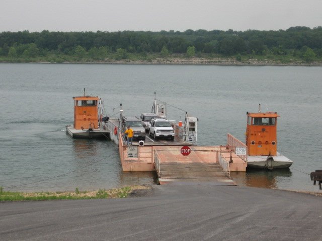
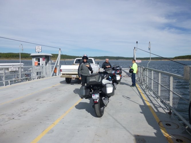
If you pass through Yellville, you aren't too far from the Peel Ferry that crosses the western end of Bull Shoals - https://www.arkansas.com/peel/peel-ferry
If you pass through Yellville, you aren't too far from the Peel Ferry that crosses the western end of Bull Shoals - https://www.arkansas.com/peel/peel-ferry
lee
Debbie's Servant
If you pass through Yellville, you aren't too far from the Peel Ferry that crosses the western end of Bull Shoals - https://www.arkansas.com/peel/peel-ferry
shortythorne
shortythorne
The last time I was at the Peel Ferry (Sept)., as we pulled up to the sign that states, "Stop here" as in don't pull down to the edge of the lake...four Harley riders had pulled all the way down to the edge...DUH! I asked myself, "now how the hell do they think the vehicles can get off the ferry when it approaches this side?" When they saw the ferry approaching, it FINALLY occurred to all of them the problem at hand. It was freaking hilarious watching all of them frantically backing and turning around four super heavy bikes in a very narrow area, and slightly uphill. I really was hoping one of them would let their bike drop off in the lake  . Now they had to go to the back of the line
  .
.
 . Now they had to go to the back of the line
  .
.glenfiddich
TravelsWithBarley.com
If you pass through Yellville, you aren't too far from the Peel Ferry that crosses the western end of Bull Shoals - https://www.arkansas.com/peel/peel-ferry
If we hadn't taken the ferry on the way to the Sedalia MO Rally I'd definitely take it this time. But the last time I was in the area (with Barley) we explored much of southern MO. It was hot as the dickens and I was grateful for those ice cold rivers coming out of enormous springs!
This time the focus is on northern AR.


