Whenever I mention all the good roads in Ohio to friends from out of state, they look at me as though I'm being even stranger than normal. There really are a lot of good twisties in Ohio, one just has to know where to look. After becoming a reborn biker a decade ago, it took me a while to figure out there's really two Ohio's. One was covered by glaciers in the last ice age, and was ground flat. The second Ohio wasn't. One has straight roads laid out in a grid. The second Ohio has roads that twist, curve, go over hills, and are tons of fun.
The second Ohio is about 1/3rd of the state, and is easy to find. Grab a map of Ohio, and find the northernmost point of West Virginia. Look about 10 miles further north, and you'll see the town of Lisbon. Draw a line west from there, about 1/3rd of the way across the state to Loudonville. This is where the glacier that came down over Lake Erie stopped.
From Loudonville, extend the line south to a point 15 miles south of I-70, and about 15 miles east of Lancaster. Then continue the line southwest, passing just south of Chillicothe, and on to Ripley on the Ohio-Kentucky border. This is where the larger glacier that came down over Michigan stopped.
Southeast of this line it's hard to find a dull road, short of the Interstates. Some of the longer and better roads are:
555, discussed in earlier posts, starts a little south of Zanesville, and runs south to the Ohio river.
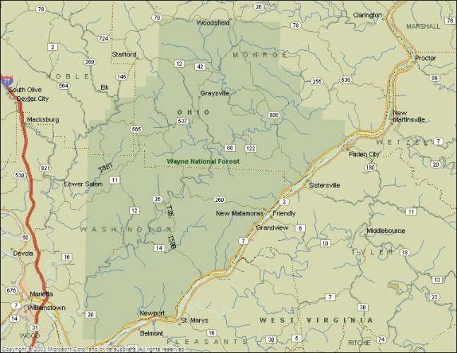
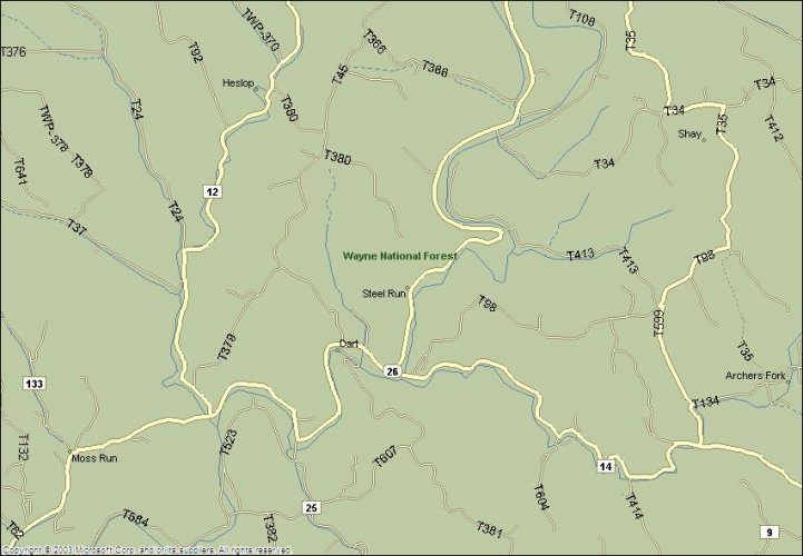
26, also mentioned in other posts, running northeast from Marietta, to it's intersection with 800.
541 east from the glacier line, through Coshocton, to it's end at I-77
60 south from the glacier line just west of Millersburg, to it's intersection with 16
164, running southwest from Lisbon, to it's end near Leesville. Especially good SW of Salineville.
There's bunches and bunches of other great roads in the second Ohio. 536, 255, 658 and many others. Yeah, getting to the glacier line from Lima will take close to two hours, but it's worth it.
The second Ohio is about 1/3rd of the state, and is easy to find. Grab a map of Ohio, and find the northernmost point of West Virginia. Look about 10 miles further north, and you'll see the town of Lisbon. Draw a line west from there, about 1/3rd of the way across the state to Loudonville. This is where the glacier that came down over Lake Erie stopped.
From Loudonville, extend the line south to a point 15 miles south of I-70, and about 15 miles east of Lancaster. Then continue the line southwest, passing just south of Chillicothe, and on to Ripley on the Ohio-Kentucky border. This is where the larger glacier that came down over Michigan stopped.
Southeast of this line it's hard to find a dull road, short of the Interstates. Some of the longer and better roads are:
555, discussed in earlier posts, starts a little south of Zanesville, and runs south to the Ohio river.
26, also mentioned in other posts, running northeast from Marietta, to it's intersection with 800.
541 east from the glacier line, through Coshocton, to it's end at I-77
60 south from the glacier line just west of Millersburg, to it's intersection with 16
164, running southwest from Lisbon, to it's end near Leesville. Especially good SW of Salineville.
There's bunches and bunches of other great roads in the second Ohio. 536, 255, 658 and many others. Yeah, getting to the glacier line from Lima will take close to two hours, but it's worth it.