Welcome, Guest! We hope you enjoy the excellent technical knowledge, event information and discussions that the BMW MOA forum provides. Some forum content will be hidden from you if you remain logged out. If you want to view all content, please click the 'Log in' button above and enter your BMW MOA username and password.
If you are not an MOA member, why not take the time to join the club, so you can enjoy posting on the forum, the BMW Owners News magazine, and all of the discounts and benefits the BMW MOA offers?
45. you can get away with 9 over. tickets are paid to the US Marshall.
the real hassle is passing. the double yellow goes on f-o-r-e-v-e-r and most people just can't find the clue to use one of the 50 gajillion turnouts to pull over and let you pass. the people "saving lives" are the absolute worst. (however, it is possible sometimes to pass by *using* the turnouts... damhikt!)
We rode it Monday from US276 up to ashville on the way to JC. Left Blue Ridge M/Cycle Campground at 7:30AM. Climbed the 7 miles up to the BRP and it was AWESOME!! Nice and cool, bright sunny morning, no traffic, 50 mph all the way to Ashville...but it was Monday morning!
As Visian says...weekends...forget it!
From Cliff McEwen Events Director BMW MC of Ontario Canada
Hello Ted I'm orginizing a groupe of riders from our club who want to ride down together to the National. We will cross the border at Buffalo NY take Hwy 219 south. I like your route plan from Harrisonburg to Gray.
However I would ride the #219 to huttonsville WV take Hwy 250 through the Monongahela National Forest to Dowell WV and hook up to your route on Hwy #678 .
Some of our club members are on Rt's 2 up, I expect your route is all paved roads?
would this be correct? Please advise
Thanks,
If you come down Rt. 42, there is camping at Big Falls Road on the New River. http://www.newriverjunction.com/ At the intersection of Rt. 42 and Rt. 460 (Newport, VA, north of Blacksburg, VA) Go straight on Spruce Run Road, SR 605 At the end of SR 605, turn Left on SR 625 Part of 625 is gravel. It passes a campground on the gravel part. New River Junction is across the Montgomery County line where the road turns back to paved surface. I haven't camped there, but spent many fun afternoons on the river.
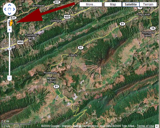
Rt. 91 is an awesome backroad, but it is pretty degraded in the higher elevations with a single lane pave and hard-pack making up the rest of the road. You can always skip it by taking a left on (great road in its own right!) Rt. 16 in Frog Level and joining up Rt. 42 about 10 miles earlier than if you were to take Rt. 91. The entire length of Rt. 91 is covered by Google Street View (drag the little yellow guy at the top of the scale to the road and you can see the actual road) so you can "preview" it and see if you want to take it.
Go to GoogleMaps and go to this section of West Virginia. Look to the left for the little yellow "Street View" guy:
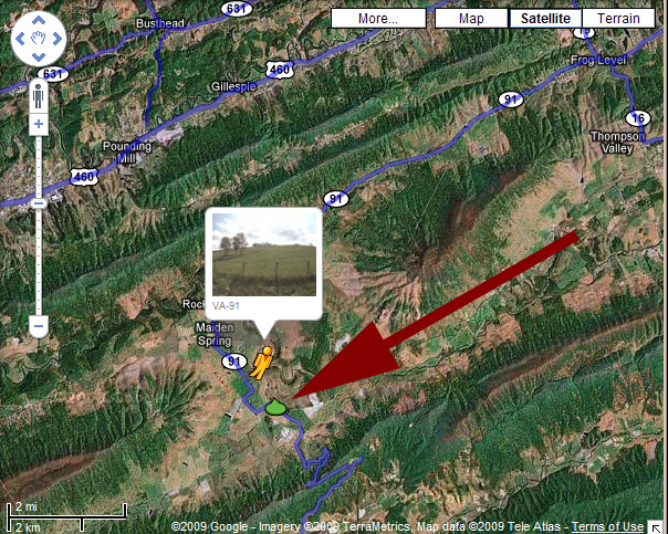
Click on him and drag him to the road you want to see:
Here you can see the road approach to the ridge lines - it is a bit narrow in this part but in good shape and lots of fun.
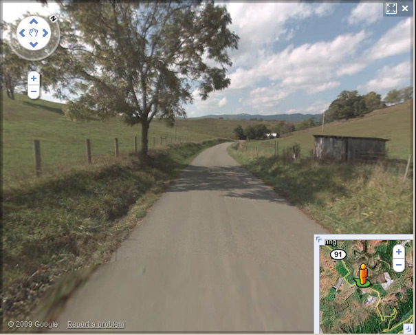
Here in this part you are up in the views at the top of the peak - it is single-lane somewhat degraded pavement with hard-pack sides, but still a lot of fun.
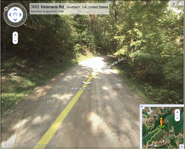
I was last through here a few years ago and my Delorme notes are that is is winding with great views and lots of "oldness" to the countryside. If you are riding fast and making miles, think about taking Rt. 16.
I plan on a 600 mile day. leaving at 6:00am should be there by 7:00pm. I did 9 New England states last Sunday, 660 miles about 2/3rds slab and was done in 15 hours.
Rt. 91 is an awesome backroad, but it is pretty degraded in the higher elevations with a single lane pave and hard-pack making up the rest of the road. You can always skip it by taking a left on (great road in its own right!) Rt. 16 in Frog Level and joining up Rt. 42 about 10 miles earlier than if you were to take Rt. 91. The entire length of Rt. 91 is covered by Google Street View (drag the little yellow guy at the top of the scale to the road and you can see the actual road) so you can "preview" it and see if you want to take it.
Go to GoogleMaps and go to this section of West Virginia. Look to the left for the little yellow "Street View" guy:
Click on him and drag him to the road you want to see:
Here you can see the road approach to the ridge lines - it is a bit narrow in this part but in good shape and lots of fun.
Here in this part you are up in the views at the top of the peak - it is single-lane somewhat degraded pavement with hard-pack sides, but still a lot of fun.
I was last through here a few years ago and my Delorme notes are that is is winding with great views and lots of "oldness" to the countryside. If you are riding fast and making miles, think about taking Rt. 16.
")