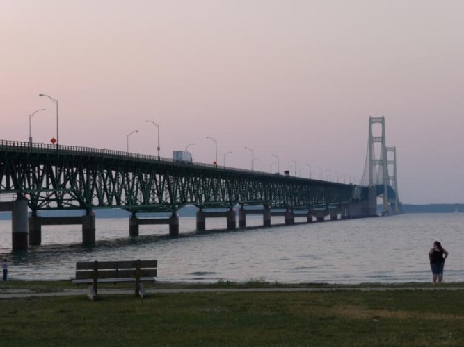
I left Traverse City with a wet tent and a damp me. After traveling for a while, I began to wonder about the wisdom of my gps. At breakfast, I had an 'aha' moment. I had set the gps to avoid tolls, so, of course, it was not going to take me to the Mackinac Bridge. Once I changed that, I was on my way. I avoided the interstate until about 30 miles south of the bridge. Trafiic was slow due to a lane closure, the paved lane. I enjoyed the crossing on the grate. Have your $4 ready and stop in to the visitor center. Great maps and guides. I left there and followed the coast until turning north to Grand Malais. It was 52 degrees at Lake Superior. Back in town, I followed the signs for Pictured Rocks and Munising. It was a great road with nice curves before it turned into the straightest road in Michigan. I'm now at the Tourist Park in Marquette. It has great sites, all grass, and only a 2.4 mile walk to The Vierling Restaurant. It's a brew pub with a fine imperial ipa. Walk, don't ride. I've finally met a couple of fellow travelers, Don, from Traverse City, and Ross(I think) who'll be showing off his new knee at the recharging site. Safe travels, all, and please add your experiences to the thread.
-
Welcome, Guest! We hope you enjoy the excellent technical knowledge, event information and discussions that the BMW MOA forum provides. Some forum content will be hidden from you if you remain logged out. If you want to view all content, please click the 'Log in' button above and enter your BMW MOA username and password. If you are not an MOA member, why not take the time to join the club, so you can enjoy posting on the forum, the BMW Owners News magazine, and all of the discounts and benefits the BMW MOA offers?
-
Beginning April 1st, and running through April 30th, there is a new 2024 BMW MOA Election discussion area within The Club section of the forum. Within this forum area is also a sticky post that provides the ground rules for participating in the Election forum area. Also, the candidates statements are provided. Please read before joining the conversation, because the rules are very specific to maintain civility.
The Election forum is here: Election Forum
Day 4, Can't ask for more
- Thread starter 83014
- Start date