PacWestGS
25-MPH NEXT 1OO MILES
Here is much of the plan, if you locals could give me a push here and there, or tell me a road is closed it would be much appreciated. These are loosly made and we are not on a daily schedule to be somewhere for each night.
Peaks of America Tour Route (July 6 ÔÇô 30, 2006)
Day 1 (Thursday July 6, 2006)
WA 7 South (w/ alternate plan through Mount Rainier NP depending on whether Hwy 706 is open to WA 123 South to Hwy 12)
WA 12 East (Yakima, WA) to I-82 South to I-182 (Richland, WA)
WA 124 East (Burbank to Waitsburg, WA)
US 12 North and East to Lewiston,WA
Camp in Hells Gate SP (Maybe)
Day 2 (Friday July 7) (Two Options Depending Local Advice) (Might be days 2 and 3)
Snake River Road South (This may be an Improved Dirt Road?) or,
WA 129 South to OR 3 South to (Enterprise, OR) then OR 82 East to Imnaha (HellÔÇÖs Canyon NRA)
Most of the day will be spent exploring HellÔÇÖs Canyon with planned trip to Hat Point and POIs in the Park.
Ultimately exiting the Park on Hess Road South, Idaho Power Road to Oxbow, OR
OR 71 South (Along Oxbow Reservoir) Cross in to Idaho and continue on Hwy 71 to (Cambridge, ID)
US 95 East to Indian Valley Road (Near Messa) then South becoming Four Mile Road and finally Van Duessen Road to ID 52 (Emmett, ID)
ID 16 South to Beacon Light Road East a right and a left and a few more turns until of State Street into Boise, ID
Day 3-4 (BMW RA Rally Sat-Sun July 8-9)
Day 5 (High-speed Day Time vs Distance)
I-84 Southeast to I-15 South (Via Twin Falls, ID)
I-15 South to near St. George
Long day motel with a hot bath and a comfy bed
Day 6-7-8 (Tuesday - Thursday July 11 - 13)
UT 9 East (POIs Zion NP) to Mt. Carmel Junction
US 89 North (Hillsdale, UT)
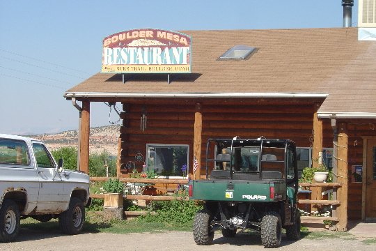
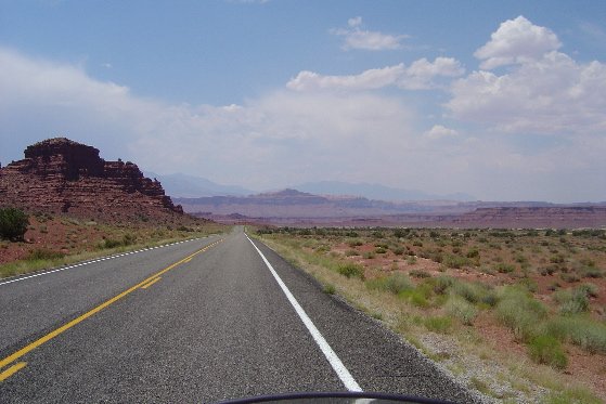
UT 12 East (RubyÔÇÖs Inn, Bryce Canyon NP, Escalante, Bolder UT and North to Torrey, UT)
UT 24 East (Capital Reef NP) to Hanksville
UT 95 South (Glen Canyon NAR / Lake Powell, Natural Bridges NatÔÇÖl Monument)
US 191 North to Monticello, UT
No plans for stops, Camp, Motel, visual stimulation will dictate pace.
Day 9-10-11 (Top of the Rockies BMW Rally) (Friday ÔÇô Sunday July 14 - 16)
CO 141 North (Egnar, CO) to (Naturita, CO)
CO 90 North to Montrose, CO
US 50 East to Blue Mesa Reservoir
CO 92 North to Hotchkiss, CO
Cr.-J. 75 North to Paonia, CO
Camp/Motel? (Saturday Night Only (When we get there? When we leave?)
CO 133 North to Carbondale, CO
CO 82 South to Balltown, CO
US 24 East to Florissant Fossil Beds NatÔÇÖl Monument
(Maybe a detour up Cripple Creek Road to Victor and back around CO 67 to US 24)
US 24 East to Pikes Peak Highway and up the Mountain.
Day 11 (I plan to be in/around Colorado Springs and Pikes Peak)
Plan to spend the night at Fort Carson, my second US Duty Station BEQ
Day 12 (High-speed day #2)
CO 94 East to (Aroya, KS)
US 40 West (Kit Carson, KS and onward to Oakley, KS)
I-70 East to (Fort Riley, KS my first Duty Station in the Army)
Plan on spending the night here in BEQ
Day 13 (High-speed day #3)
KS 18 and US 24 East to Lawrence, KS (DoesnÔÇÖt somebody live in Lawrence?)
I-70 East to Saint Louis and the BMW MOA HeadquartersÔÇÖ (and the Arch of course)
East until we get tired Motel time for sure. (Maybe Effingham, IN)
Day 14 (Wednesday, July 19) (Memorial Detour YB in IN)
I-70 East to Terre Haute
IN 46 South to Bloomington, IN
IN 37 North through Indianapolis, IN to IN 13 North to Wabash, IN
(Anybody home?)
Stop by GarthÔÇÖs Grave (Because after all this tour is in his memory)
Day 15 (Needs to be a quick day itÔÇÖll be long for sure)
US 24 East and North up through Fort Wayne
I-69 North to I-80 to I-90 (Cleveland, OH) to I-190 (Buffalo, NY)
Maybe detour to Niagara Falls (Depends on a lot of things, time being one of them)
Day 16 (Friday, July 21)
I-90 East to (Utica, NY) (MapQuest is routing me south to NY Hwy 5 East from Canastota to Utica?)
NY 12 North to NY 8 (Chester Township, VT)
US 9 North to VT 74 East to Corduroy Road North to Crown Point Township
VT 9N to Lake Road
Lake Road to VT 903 to VT 17 North (Still Lake Road)
Right on Panton Road to Monkton
Monkton Road North to Silver Road North (VT 116)
2A North to Essex Junction
There I plan get a hot meal, a shower, and have a darned cold beer with someone or two or more.
Day 17-18 (Saturday-Sunday July 22 ÔÇô 23, BMW MOA Rally)
After that IÔÇÖve got one week to get home, wife will probably be on an airplane, so I donÔÇÖt know yet what IÔÇÖll have left.
Peaks of America Tour Route (July 6 ÔÇô 30, 2006)
Day 1 (Thursday July 6, 2006)
WA 7 South (w/ alternate plan through Mount Rainier NP depending on whether Hwy 706 is open to WA 123 South to Hwy 12)
WA 12 East (Yakima, WA) to I-82 South to I-182 (Richland, WA)
WA 124 East (Burbank to Waitsburg, WA)
US 12 North and East to Lewiston,WA
Camp in Hells Gate SP (Maybe)
Day 2 (Friday July 7) (Two Options Depending Local Advice) (Might be days 2 and 3)
Snake River Road South (This may be an Improved Dirt Road?) or,
WA 129 South to OR 3 South to (Enterprise, OR) then OR 82 East to Imnaha (HellÔÇÖs Canyon NRA)
Most of the day will be spent exploring HellÔÇÖs Canyon with planned trip to Hat Point and POIs in the Park.
Ultimately exiting the Park on Hess Road South, Idaho Power Road to Oxbow, OR
OR 71 South (Along Oxbow Reservoir) Cross in to Idaho and continue on Hwy 71 to (Cambridge, ID)
US 95 East to Indian Valley Road (Near Messa) then South becoming Four Mile Road and finally Van Duessen Road to ID 52 (Emmett, ID)
ID 16 South to Beacon Light Road East a right and a left and a few more turns until of State Street into Boise, ID
Day 3-4 (BMW RA Rally Sat-Sun July 8-9)
Day 5 (High-speed Day Time vs Distance)
I-84 Southeast to I-15 South (Via Twin Falls, ID)
I-15 South to near St. George
Long day motel with a hot bath and a comfy bed
Day 6-7-8 (Tuesday - Thursday July 11 - 13)
UT 9 East (POIs Zion NP) to Mt. Carmel Junction
US 89 North (Hillsdale, UT)
UT 12 East (RubyÔÇÖs Inn, Bryce Canyon NP, Escalante, Bolder UT and North to Torrey, UT)
UT 24 East (Capital Reef NP) to Hanksville
UT 95 South (Glen Canyon NAR / Lake Powell, Natural Bridges NatÔÇÖl Monument)
US 191 North to Monticello, UT
No plans for stops, Camp, Motel, visual stimulation will dictate pace.
Day 9-10-11 (Top of the Rockies BMW Rally) (Friday ÔÇô Sunday July 14 - 16)
CO 141 North (Egnar, CO) to (Naturita, CO)
CO 90 North to Montrose, CO
US 50 East to Blue Mesa Reservoir
CO 92 North to Hotchkiss, CO
Cr.-J. 75 North to Paonia, CO
Camp/Motel? (Saturday Night Only (When we get there? When we leave?)
CO 133 North to Carbondale, CO
CO 82 South to Balltown, CO
US 24 East to Florissant Fossil Beds NatÔÇÖl Monument
(Maybe a detour up Cripple Creek Road to Victor and back around CO 67 to US 24)
US 24 East to Pikes Peak Highway and up the Mountain.
Day 11 (I plan to be in/around Colorado Springs and Pikes Peak)
Plan to spend the night at Fort Carson, my second US Duty Station BEQ
Day 12 (High-speed day #2)
CO 94 East to (Aroya, KS)
US 40 West (Kit Carson, KS and onward to Oakley, KS)
I-70 East to (Fort Riley, KS my first Duty Station in the Army)
Plan on spending the night here in BEQ
Day 13 (High-speed day #3)
KS 18 and US 24 East to Lawrence, KS (DoesnÔÇÖt somebody live in Lawrence?)
I-70 East to Saint Louis and the BMW MOA HeadquartersÔÇÖ (and the Arch of course)
East until we get tired Motel time for sure. (Maybe Effingham, IN)
Day 14 (Wednesday, July 19) (Memorial Detour YB in IN)
I-70 East to Terre Haute
IN 46 South to Bloomington, IN
IN 37 North through Indianapolis, IN to IN 13 North to Wabash, IN
(Anybody home?)
Stop by GarthÔÇÖs Grave (Because after all this tour is in his memory)
Day 15 (Needs to be a quick day itÔÇÖll be long for sure)
US 24 East and North up through Fort Wayne
I-69 North to I-80 to I-90 (Cleveland, OH) to I-190 (Buffalo, NY)
Maybe detour to Niagara Falls (Depends on a lot of things, time being one of them)
Day 16 (Friday, July 21)
I-90 East to (Utica, NY) (MapQuest is routing me south to NY Hwy 5 East from Canastota to Utica?)
NY 12 North to NY 8 (Chester Township, VT)
US 9 North to VT 74 East to Corduroy Road North to Crown Point Township
VT 9N to Lake Road
Lake Road to VT 903 to VT 17 North (Still Lake Road)
Right on Panton Road to Monkton
Monkton Road North to Silver Road North (VT 116)
2A North to Essex Junction
There I plan get a hot meal, a shower, and have a darned cold beer with someone or two or more.
Day 17-18 (Saturday-Sunday July 22 ÔÇô 23, BMW MOA Rally)
After that IÔÇÖve got one week to get home, wife will probably be on an airplane, so I donÔÇÖt know yet what IÔÇÖll have left.
Last edited: