•  

    Welcome! You are currently logged out of the forum. Some forum content will be hidden from you if you remain logged out. If you want to view all content, please LOG IN!

    If you are not an MOA member, why not take the time to join the club, so you can enjoy posting on the forum, the BMW Owners News magazine, and all of the benefits of membership? If you click here, you have the opportunity to take us for a test ride at our expense. Enter the code 'FORUM25' in the activation code box to try the first year of the MOA on us!


Where are the Highest Roads & Peaks Across the US?

TexanRT

Email me at gpodzo@msn.com and I could send you pictures and maps. After thinking of it, you could do Mtn. Evans and Pikes Peak in one day if you hit Mtn. Evans in the early morning and drive the 60 miles or so to the Pikes Peak tole road which has hours. The "100,000" foot ride is offered every summer and is on the list of rides and ralleys by BMWMOA.

gpodzo
 
3 passes

I live in CA so have been over Tioga a few times, we lived in Denver briefly a couple years ago so got to do Mt Evans and while there, the Wyoming one mentioned above

They are all good roads and stunning rides, highly recommended. Around Evans there is a rustic restaurant, fairly large, really worth stopping at. I can't remember the name but you'll see it, there's no malls up there to hide it (yet).

I lived in Illinois till '84, besides no elevation, I had to ride about 20 miles out of town to find a TURN that wasn't a right angle. We'd run up and back on that 1 mile winding stretch for an hour. When the interstate came through, we finally got to practice turns on the cloverleaf!
 
I do not have any current digital pictures )yet), but the road to Mt. Evans in Colorado is the highest paved road in North America. I will be there again in July on my new GSA. I will have pics. At the peak, your 14,292 ft. above seal level. And you can ride all the way up till you hit the parking lot, which is about 50 feet below the peak if I remember right.

But will cost you you to even stop the cycle to take a picture... the USFS is charging 10$ just to ride up the road even though it is a state maintained road... got a lot of locals peed off about it and they have a platoon of FS employee slaceys to impress the point if you get the free pass to just drive the road and NOT STOP...

there is the highest pass roads in NA in Colorado also. Independance pass is 12200Ft Paved (highest contiunous pass road in NA) and Mostiquio Pass is the highest contiunous pass road in NA at 13185Ft but a very rough dirt road.. also there is Pikes Peak up to 14K
 
Any maps? Photos? That's exactly the kind of ride I want to plan. :thumb

Yes definately do the 100,000' ride!!!
I did it in 2002.. met many a great people and the ride was Fantastic!!! 4 stars!!!
Put on every year by one of the Colorado Dealers and BMW Club's in early August so you still have time to signup.
Beautiful scenery,roads etc...Rally with food-band-gifts...!
You get a map (I still have) and ride at your own pace. About 500 miles total so a good days ride. Each year I'm told they change things/routes a little so as to not be boring but basically the same towns /passes are visited. I also heard they do this in the Fall only route it backwards.
A must DO...!
 
Don had been talking about going out onto South Padre Island and riding around there a bit and then coming back through Port Aransas and Anransas Pass. Now, you Texans will have to excuse a greenhorn Californian like myself, but when someone talks about a Pass road, I think of Tioga (mentioned above) or maybe something like Passo Stelvio in Italy, at or above 10,000 feet. So, I asked Don, "just how high is Aransas Pass?" He gave me a funny look and said "About 20 feet." When we actually got there, I found that the "pass" is actually a waterway and there's a bridge over it.

Unfortunately, all the passes in the Gulf Coast states are at sea level -- Aransas Pass, San Luis Pass, Rollover Pass, Sabine Pass, Southwest Pass..... :)
 
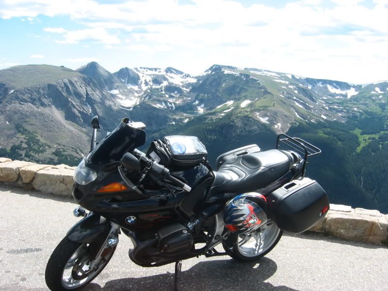
Trail Ridge Road thru RMNP is the highest paved road in any National Park
11Smntnforest.jpg
, at a peak of 12,188. With 54 "14ers" (mountains over 14,000'), CO is the undisputed Big Elevation state.
The 100,000 Ft. ride takes a different route each year, albeit it many of the passes (Vail, Loveland, Hoosier, Guanella, Fremont- all over 11thou) are kept on the list, primarily due to their proximity to Denver.
 
In Kansas it is Mt. Sunflower. Approximately 4,000 feet. The top of a knoll in a field near the Colorado line.
 
In Kansas it is Mt. Sunflower. Approximately 4,000 feet. The top of a knoll in a field near the Colorado line.

I climbed that free handed once ..never again.......:laugh:laugh:laugh:laugh

I guess you really need to see that hill to think thats funny.........
 
Hi,
Monitor Pass in central Cali is not the highest, but it sure is fun to run!
Picture172.jpg
 
Louisiana Highest Point

Name: Driskill Mountain
Elevation: 535 feet (163 meters)
Location: 5.3 miles southeast of Bryceland, Louisiana.
Township and Range: Northeast corner of Section 32, T.17N., R.5W.
Parish: Bienville
Looks like LA 507 goes right past it.

I think we need a state by state report on this then some enterprising soul can put together a Grand Tour.

+1:thumb
 
In the Show Me State

It is Taum Sauk Mountain all 1772 feet of it. We are a little above that here on the old Fire Tower on the top of it.

560591822_Yyfeu-L.jpg


Here's a view over the horizon.

560594222_Z8CWm-L.jpg


For those of you who go to the Falling Leaf Rally, it's just a little south of Potosi.
 
tourdefrank163.jpg


My former RT @ Mt Davis, Pennsylvania, 3,213 feet above sea level.
Mt davis is located south east of Pittsburgh, in the western part of PA.

looking at the pix of the highest roads out in Colorado, old Pennsyltuckey can't hold a candle to THAT, per se. BUT we do have miles upon miles if traffic-free mountain roads.

unlimited back road riding = miles of smiles.
 
About 20 years ago I embarked on visiting the highest points in each state. The info was on each page in the Rand McNally atlas. I found that many states had markers or even state parks at or near the point.

Examples: Guadalupe NP for Texas highest point. Mt Davis, PA has an overlook as does Brasstown Bald in GA. Clingmans Dome and Mt Mitchell in Tenn and NC are accessible from NP roads (BRP in NC). Spruce Knob in WV has a gravel rd to the top. rode a Concours up it. Now I have a GSA :)

Backbone Mt is a ridge in Maryland and US 50 crosses near the high point which is actually on the WV/MD stateline. Mt. Cheah in Alabama is a state park on top of the mountain with lodge and restaurant.

I even have pix with home-made signs (pre computer days). It was a grand quest.

I'd considered making my next one going to county courthouses, but I heard about some guy named Higdon who has already done that :clap
 
went over the Jefferson Notch Road in the White Mountains again this weekend, 3009 ft, highest publicly maintained road in NH although i didn't see another motorcycle on it for the whole 10 miles and there was thousands of bikes all over for laconia.
 
Back
Top