rwadamsidaho
Member
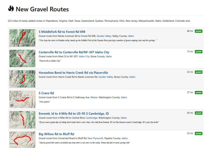
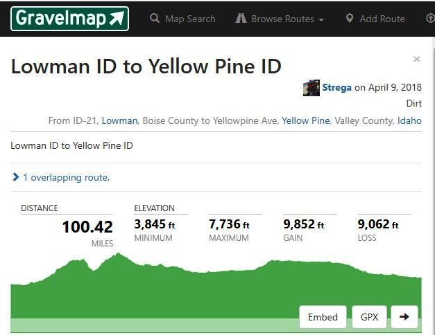
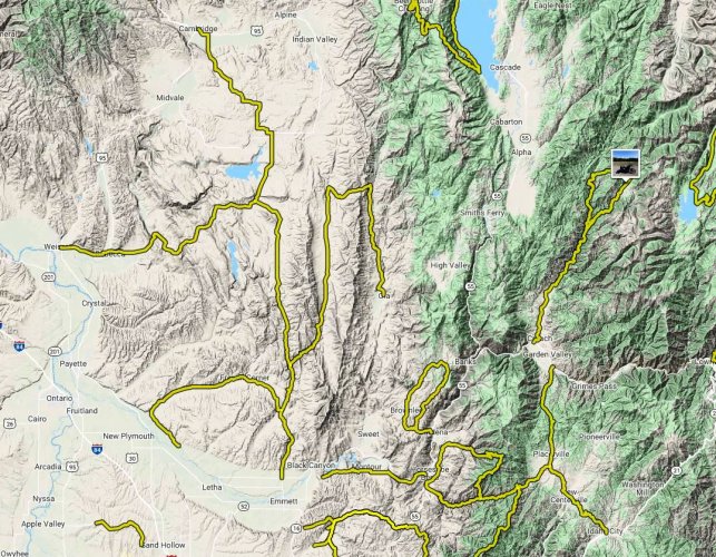
Living in South West Idaho, I have hundreds of miles of non-paved roads to choose from. From all weather gravel to seasonal forest service and logging roads. The Idaho BDR passes within 30 miles of my home. But just looking at a county road map is not a very helpful way of finding a great ride route. While researching the number of miles of unpaved roads in my county (GEM) on the internet I came a crossed a great web site for the rider looking for gravel and dirt roads in there area. After checking out the site, I noticed that some of my favorites were not listed, so I became a member and added many of my favorite rides. https://gravelmap.com
About Gravelmap
Gravelmap is an interactive database of gravel and dirt roads and paths, submitted and managed entirely by people who ride them.
Biking on gravel roads, or "gravel grinding," is becoming increasingly popular. While it may not be a new concept, it is one that is quickly spreading as people discover how awesome it is to explore less-traveled, quiet backroads via bicycle.
Gravelmap was started with two purposes in mind: give people a way to discover new gravel roads in their area, and allow them to post and manage their favorite routes for others to enjoy. Web-based mapping tools are a great resource for planning rides, and while they generally contain plentiful road data, they have a couple of shortcomings:
No road surface data. Online maps generally do not give any indication of a road's surface type. If you're planning on riding gravel (or if you want to avoid it), you have to rely on satellite imagery, which may or may not tell you what you need to know about a road's surface. Unless you've ridden or driven the road before, the process is largely one of guesswork.
Is the road traversible? Is it on private property? Does it even exist? Occasionally, especially in rural areas, an appealing road on a map may end up being inaccessible due to land ownership, gates, adverse conditions or other situations that a map alone will not indicate. That's why all routes on Gravelmap are user-created. We encourage people to post routes that they've ridden before and know are free of restrictions. As a result, while gravel roads don't actually show up on Gravelmap until someone adds them, you can use them to plan a ride with confidence.
Gravelmap was launched on April Fools' Day 2014, though it ain't no joke. Please don't hesitate to get in touch with us with any feedback, bug reports, criticisms or suggestions.

 https://gravelmap.com
About Gravelmap
Gravelmap is an interactive database of gravel and dirt roads and paths, submitted and managed entirely by people who ride them.
Biking on gravel roads, or "gravel grinding," is becoming increasingly popular. While it may not be a new concept, it is one that is quickly spreading as people discover how awesome it is to explore less-traveled, quiet backroads via bicycle.
Gravelmap was started with two purposes in mind: give people a way to discover new gravel roads in their area, and allow them to post and manage their favorite routes for others to enjoy. Web-based mapping tools are a great resource for planning rides, and while they generally contain plentiful road data, they have a couple of shortcomings:
No road surface data. Online maps generally do not give any indication of a road's surface type. If you're planning on riding gravel (or if you want to avoid it), you have to rely on satellite imagery, which may or may not tell you what you need to know about a road's surface. Unless you've ridden or driven the road before, the process is largely one of guesswork.
Is the road traversible? Is it on private property? Does it even exist? Occasionally, especially in rural areas, an appealing road on a map may end up being inaccessible due to land ownership, gates, adverse conditions or other situations that a map alone will not indicate. That's why all routes on Gravelmap are user-created. We encourage people to post routes that they've ridden before and know are free of restrictions. As a result, while gravel roads don't actually show up on Gravelmap until someone adds them, you can use them to plan a ride with confidence.
Gravelmap was launched on April Fools' Day 2014, though it ain't no joke. Please don't hesitate to get in touch with us with any feedback, bug reports, criticisms or suggestions.


 https://gravelmap.com