jeffryasmith
bmw2003gs

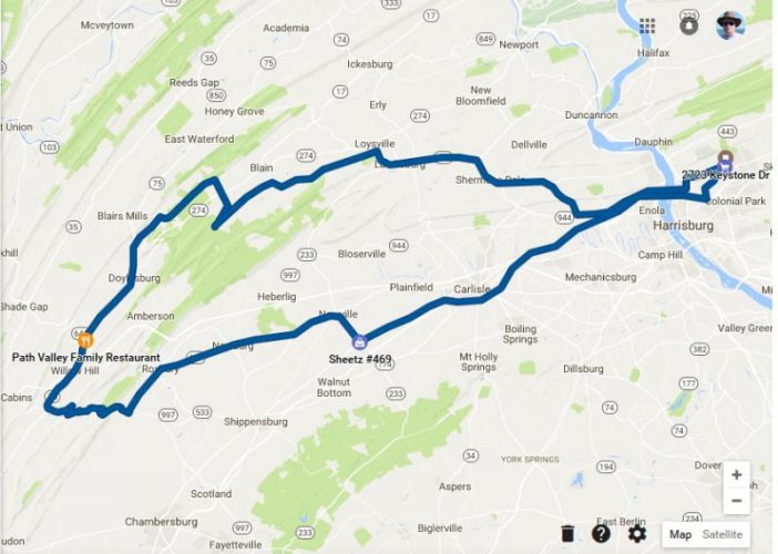
I rode out through the Tuscarora State Forest Oct 30 and north of New Germantown I found that the gate on Concord Road was open and a sign posted that it would remain open through the end of deer season. First time I had a chance to ride on this road. Knife edge on top of the ridge, rocky but not bad over all.
")
I followed mostly back roads through western Perry County until Fowlers Hollow SP, then over the ridge to the Covered Bridge south of New Germantown, then up onto the Conococheague Ridge. After that, out Horse Valley and down to the Path Valley Family Dinner for coffee.
On the way back. went to Fannetsburg, down 75 then crossed over the mountains to Roxburry on some nice twisties. Better than riding on 641 IMO. With the approaching storm visible over Blue Mtn as I hit Newville, I grabbed a patch of I81 and 'beamed' home just in time to be in the garage before the rain fell.
Attachments
Last edited: