• Welcome, Guest! We hope you enjoy the excellent technical knowledge, event information and discussions that the BMW MOA forum provides. Some forum content will be hidden from you if you remain logged out. If you want to view all content, please click the 'Log in' button above and enter your BMW MOA username and password.

    If you are not an MOA member, why not take the time to join the club, so you can enjoy posting on the forum, the BMW Owners News magazine, and all of the discounts and benefits the BMW MOA offers?

  • Beginning April 1st, and running through April 30th, there is a new 2024 BMW MOA Election discussion area within The Club section of the forum. Within this forum area is also a sticky post that provides the ground rules for participating in the Election forum area. Also, the candidates statements are provided. Please read before joining the conversation, because the rules are very specific to maintain civility.

    The Election forum is here: Election Forum

After the Blanco River Memorial Weekend flood

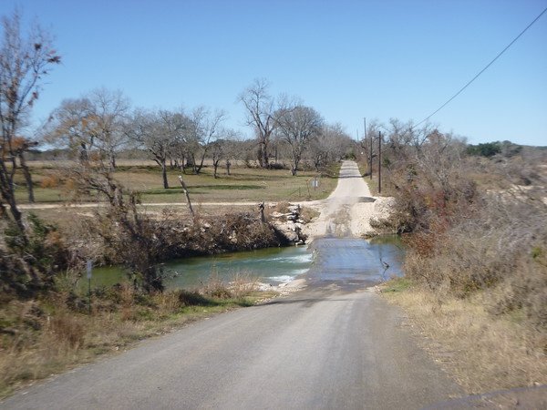
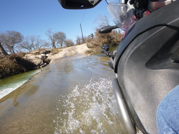
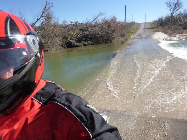
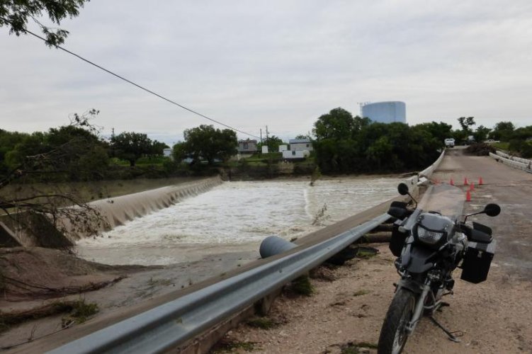
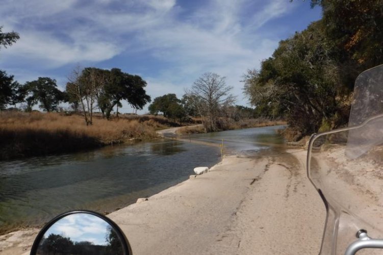
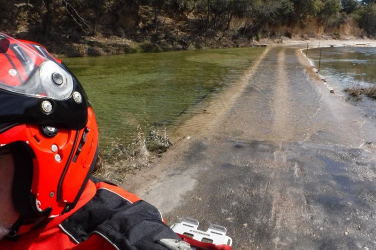
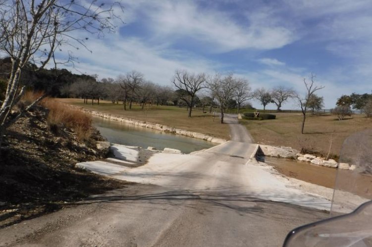
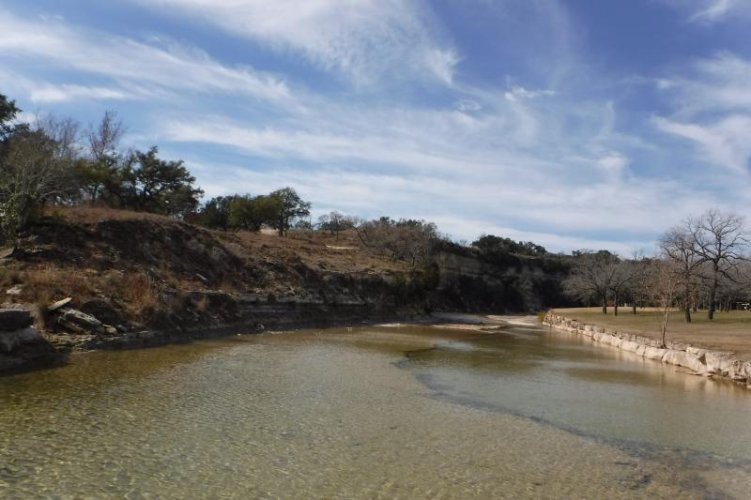
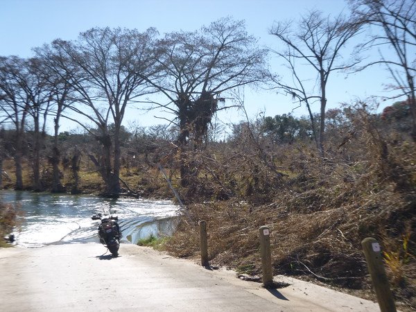
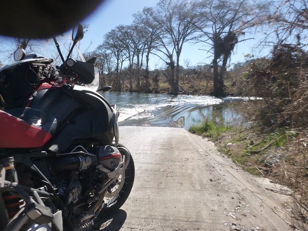
South of Wimberley is this low water crossing on Wayside Dr that takes you over to RR 32. . Locals call it Slime Bridge as it gets pretty slick in the summer. I have seen many a jeep and pickups with teenagers off the edge. It is on a downhill and a curve, so you cannot line up without a turn and some braking...always a fun crossing. Typically only an inch or two of water...today I decided it wasn't worth the attempt as I have not seen the deck in some time and have no idea what shape it is in...not falling over today!
P1090455-M.jpg

P1090458-M.jpg


You can see the debris in the cypress trees...40' or so above river.
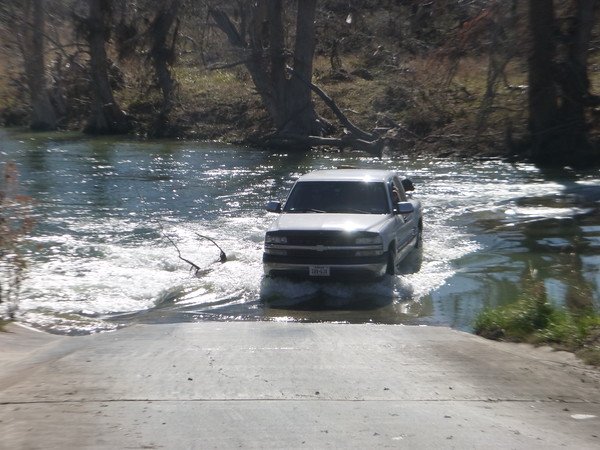
P1090466-M.jpg

These kids stopped at the top of the hill on other side and finally gave it a go...I'm still turning around today! They stopped and said the truck was sliding.
 
Fischer Store Bridge after post # 10 before shots

Had not heard they were actually moving quickly on the replacement
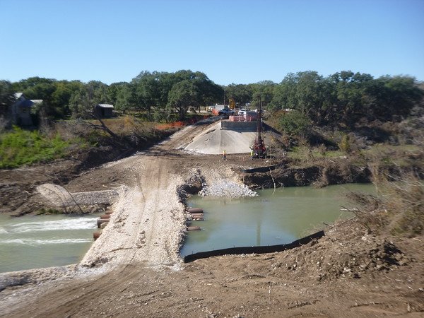
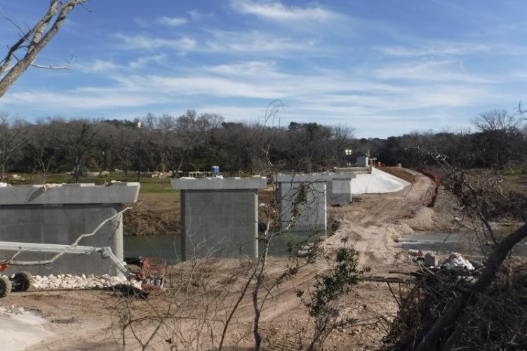
Pulled up to Wimberley side to see this. Temporary work crossing and pier drilling in progress:thumb

P1090489-M.jpg

P1090482-M.jpg

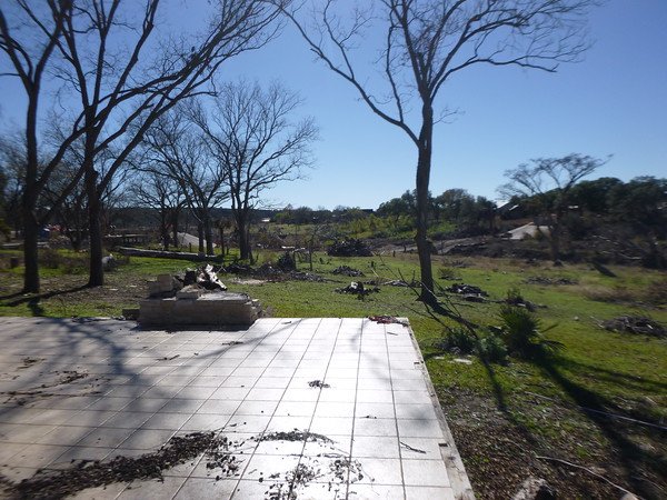
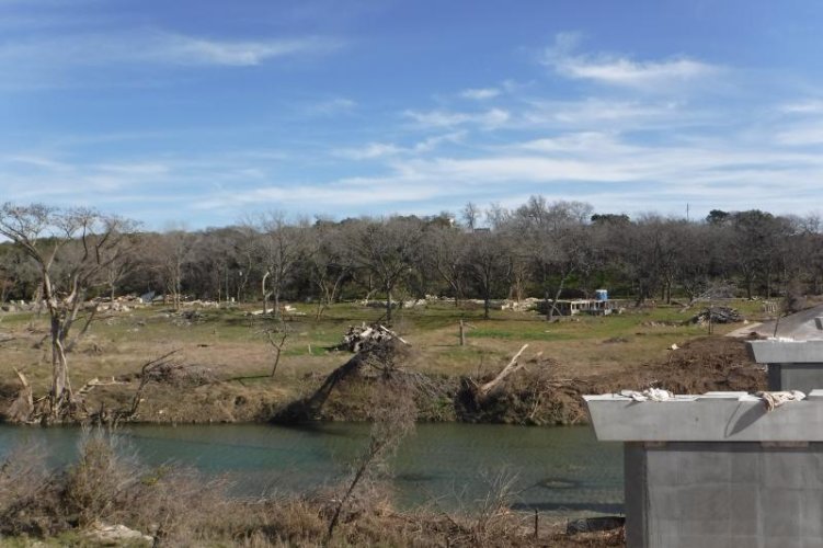
Standing on one of the slabs in this small neighborhood. We had actually priced one with interest before we bought our place. These homes were so far back and on a hillside from the river...never thought I would see them scraped clean. You can see the bridge work in the background

P1090487-M.jpg

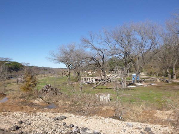
This used to be a very shaded stretch of riverfront for these 8-10 homes. No signs of rebuilding at all...most likely due to need to raise significantly to re-qualify for any flood insurance...sad to see
 
Looping back towards Blanco, I took another county road( Chimney Valley) back towards the river. These crossings are dry 10 months typically except for a day or so after a rain. The springs feeding the river are running steadily now and this has been wet since Memorial Day.
P1090494-M.jpg

P1090499-M.jpg

P1090500-M.jpg
 
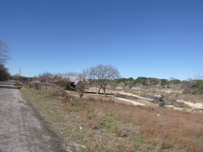
Right after that crossing was this family compound. It had a few cabins between the river and the home on the road.Water rolled thru this roadside house, also so far away from historical river levels...until then.

P1090503-L.jpg

I was talking to his neighbors a few days after the flood, he said he knew he was in trouble when two of the cabins came floating across his property!

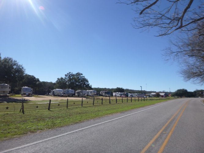
Back on 165 just east of Blanco and just north of the downed bridge sits this RV park.
It sits on a curve and all the RV's were swept downstream and all over the road in pieces...luckily no casualties. It has since been rebuilt nicer and is FULL again.
P1090507-L.jpg
 
The picture of the flood debris in the trees is pretty amazing. It makes it easier to understand why there was so much destruction. For a river to rise that high above normal, the rainfall amounts must have been tremendous, as the terrain around the river doesn't appear to be extremely steep. Hopefully that was at least a 500 hundred year flood.
 
The picture of the flood debris in the trees is pretty amazing. It makes it easier to understand why there was so much destruction. For a river to rise that high above normal, the rainfall amounts must have been tremendous, as the terrain around the river doesn't appear to be extremely steep. Hopefully that was at least a 500 hundred year flood.

If you look at that chart in #15, the flash flood wall came quick. We had somewhere around 12" in under 8 hours, close to 15" in one 16 hour stretch. They say a 1000 year event.
Seeing the debris in the trees and up high on the limestone banks is just hard to grasp. Some areas do have high banks, which were not high enough.

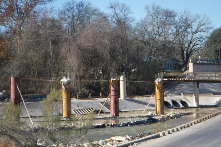
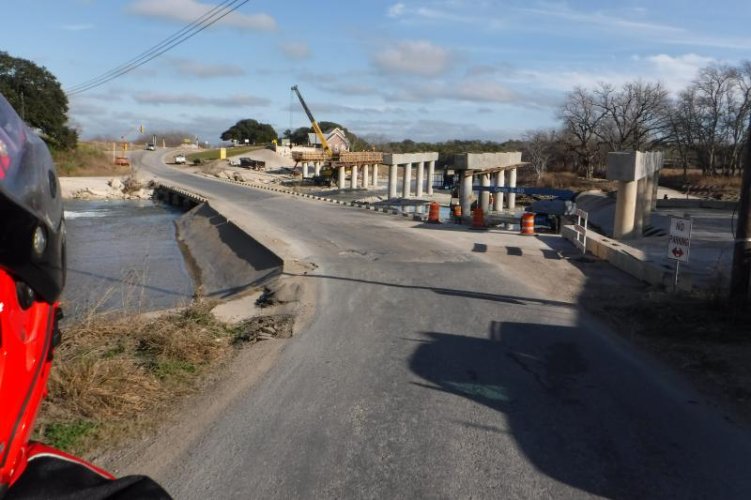
They are making rapid progress on both downed bridges. Adding additional pillars for shorter spans this time. went from three sets of supports to six on the one closest to Blanco. I rode by Wednesday to see them pouring the horizontal supports on the pillars:thumb This shot was from mid December and all the pillars have not been poured.
DSCF0240.jpg
 
Thought I took one Wednesday:scratch


DSCF1309.jpg

RM165 at Blanco with additional pilings . You bridge Engineers can compare the flat walled piling set up in post #19. The old set up looked like it would catch a lot of water to me.

Helen drove to the north side of the Fischer Store bridge today and said it looks as far along as this one. Great news and pretty fast track progress from the typical area schedule on road projects.
 
Thought I took one Wednesday:scratch


View attachment 54140

RM165 at Blanco with additional pilings . You bridge Engineers can compare the flat walled piling set up in post #19. The old set up looked like it would catch a lot of water to me.

Helen drove to the north side of the Fischer Store bridge today and said it looks as far along as this one. Great news and pretty fast track progress from the typical area schedule on road projects.


I am not an engineer, but the new bridge in the photo looks pretty stout. I don't know though if it's economically feasible to build a bridge strong enough to handle flooding of such catastrophic proportions. Good to see that construction progress is coming along well.
 
The flood failure of bridges that I have seen are not so much of the water- unless it hits the roadway, but when debris from upstream "dams" on the bridge. Water is kinda funny, I went into 6 mph river water in Alaska thinking it "shouldn't be a big deal". It wasn't as long as I held my breath :eek
OM
 
A foot of water in the right place is bad news, always curiuos about flow speed. Sometimes the brain hopefully tells you it's a bit much...one wishes anyways! One solid experience changes the cavalier approach many may take until that one bad one.

Watching that water scrape the bottom of the US 281 bridge downtown by the state park was a powerful sight. Guessing 35' above normal even here. Seen the river high by maybe 5', but this was once in a lifetime...I hope.

Not that every flood doesn't have debris, but historic record levels on a long running drought damaged river (read a LOT of dead vegetation) and tributary creeks really put a lot of mass in that flash flood .
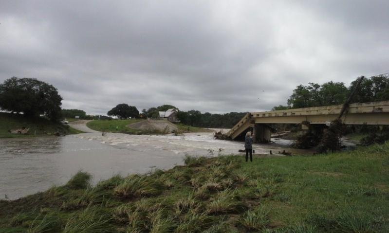
The Fischer bridge, from where it was to where it settled, must have been something to witness.

SAMSUNG RUGBY JUN 15 548.jpg

The Blanco one lost the center piers and two sections ended up slightly downstream , but it is further upstream and less debris one would think. Looking at this day after pic , a lot of debris still visible


P1000279.jpg

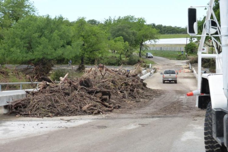
This was what was on the deck of the first bridge that the water encountered. It is a county crossing on the west side of park and about a mile from the 281 bridge. They had just ran a loader thru here when I got to it.

P1000287.jpg

There are several dams along here, from private to municipal. They all survived visually but have a lot of rocks and mud that backed up against them and new rock islands below them.
The city has been dredging the one by this bridge the past month in order to get the intakes back online( been back to wells in town) They said it was less than 2' deep on top of the debris pile The dam is about 20' tall:eek We walk on the abandoned low water crossing below that spillway when looping the park. Seems like a lot of stress against that dam.
 
Good morning Steve,

I take it you live in or around Blanco? We have friends that live a couple miles west of town, we were there Memorial weekend for their daughters wedding. Incredible to see additional pictures of the damage. We took all the "left over" food (there was a lot as not all guests could get to the wedding) to the fire department and red cross center. It was fortunate more were not killed. Thanks for posting the follow up pics!

John
 
Hi John,
Yeah, we're a few miles north of town. Typical Memorial Day with a lot of events that got impacted...good deal on the food donation:thumb
It is pretty remarkable more folks were not hurt or killed for sure, some think if it happened a few hours later in the evening things may have been way worse.
 
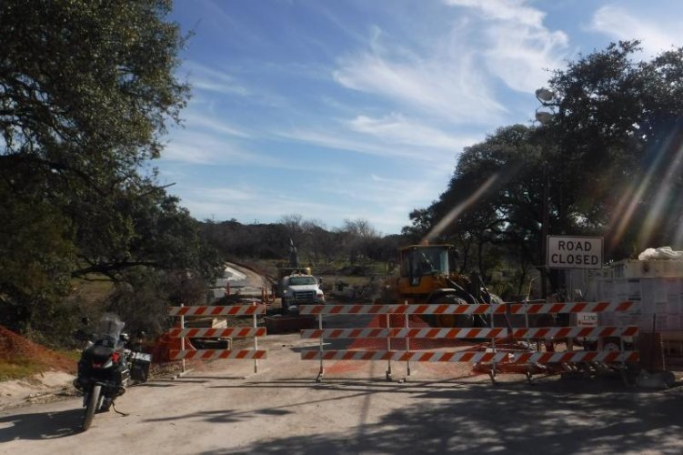
Rode over to the south side of the Fischer bridge, have not been on this side since the flood. Forgot how I missed the nice twisty run on this side:thumb


DSCF1387.jpg

This bridge was higher off the riverbed than the others and they are going back with those large supports. The drone aerial of the failure is in post #10 .
DSCF1380.jpg
I had thought about taking that temporary low water crossing as no one was working...but my spidey senses were tingling and sure enough, a sheriffs deputy came up and turned down the private drive near the barricades:whistle

So instead I got to reverse the twisty section again...knowing where the referee was:laugh

DSCF1394.jpg

The remnants across the river were those slabs I was standing on in post # 22. I remember you couldn't even see them with all the cypress trees and other trees along the bank. Most had been there since the late 70's at least without flood issues.
 
Headed back west on Ranch Road 32 to look at Little Blanco River area. It crosses 32 and US281 south of Blanco. Another typically dry creek most of the time in most spots unless dammed by ranchers.
The fairly low crossing on 32 had debris for weeks piled up where they cleared the road. The Cypress trees in that spot made it

It was in the heavy training rain bands and roared to life. It is scrubbed to it's limestone bed and wider than I have ever seen it in the 30 years I have driven the area.

This is on Little Blanco Road ( CR 101) west off of US281 near RM 473. It cuts thru the Hawn- Holt Ranch ( Principal owners of San Antonio Spurs)

DSCF1423.jpg

DSCF1430.jpg

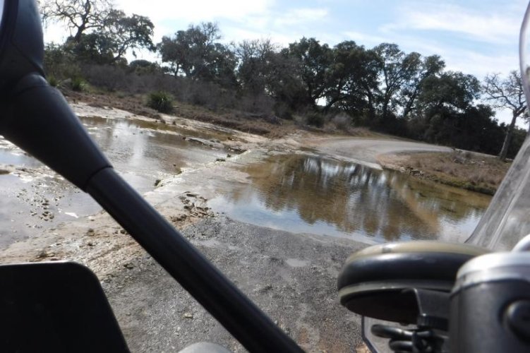
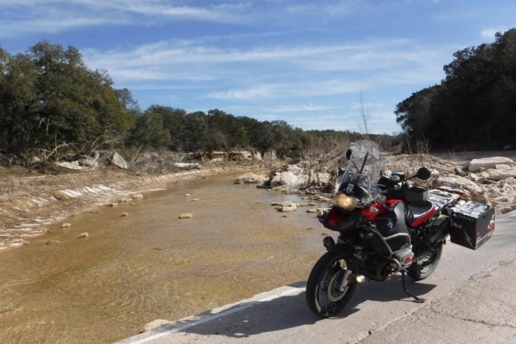
This low water is often covered unless it's July-August...often slippery as all get out and several folks I know have a story or will not travel if it's wet. I figured I got my slide out of the way on my mt. bike last week, so motored on. Made it with no slidin' :thumb


DSCF1438.jpg


Forgot about the lesser but as evil twin. This is the one that more stories have come from. So little water, but warm weather months adds a bit of algae.
H came across it sideways on her K12S a few years back but stayed up!...said "that was a lot of fun and let's not do that again" I was watching it happen in the mirror and was wishing her the best...which she pulled off:love

Oh, not slippery at all today.
 
Thanks again for the pics.
There's a couple of those roads we haven't been on, so it looks like we have some new places to check out in April.
Even if the bridges are not done I like checking out the construction.
 
A few more from Little Blanco Road

DSCF1417.jpg
Used to be heavy vegetation along banks. When riding back here and if this first low water off of US 281 has water over it means time to turn around as the others will be a few feet under!

DSCF1434.jpg
The beginning of Hawn- Holt ranch second crossing. The road is county owned/maintained but the adjoining property is private. A lot of these cut thru a ranch type roads in the area.

DSCF1435.jpg

Looking upstream from last crossing
 
Back
Top