U
Unregistered
Guest
I-84 to Boise.
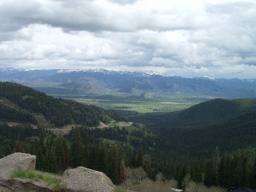
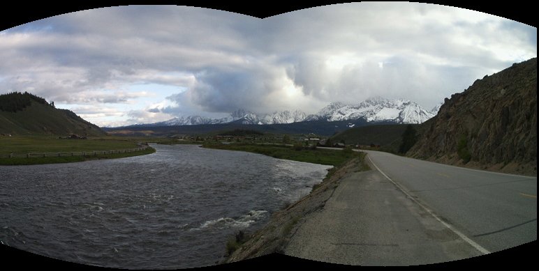
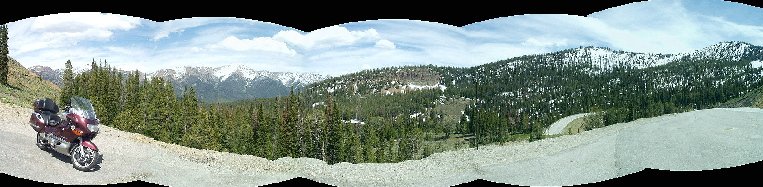
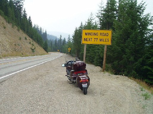
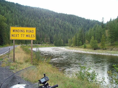
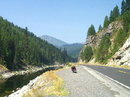
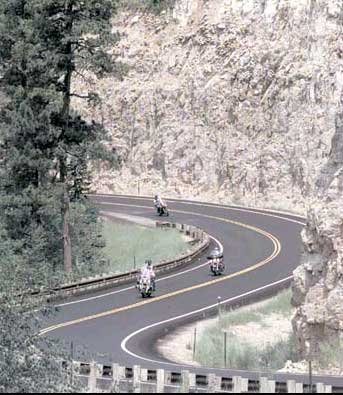
Highway 21 to Idaho City. From Idaho City to Lowman it gets a bit twisty. Lowman over 7200 ft Banner Summit to Stanley. Left on Highway 75 to Highway 93 to Salmon over Lost Trail summit at 7000 feet north to Lolo, MT, Head west on Highway 12 and the famous "Curves next 77 miles" road. Highway 12 will take you into Lewiston. 95 north on the Idaho side to Coeur d' Alene, i-90 into Spokane. Or 195 north right into Spokane.
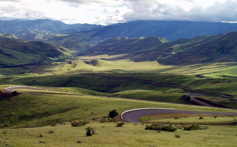
For those is a hurry, leave Boise on Highway 55 through Horseshoe Bend, McCall, New Meadows where you connect with Highway 95 through the Riggins canyon. When you reach White Bird, you have two options, Up the highway hugging the side of the hills, or through the town of Whitebird and up the old highway with its 78 hairpin turns in just a couple of miles. This was the original roadway until the early 80s. It reminds me a lot of the switchback roads of Europe. You connect back up with Highway 95 at the top of the hill. When you reach Grangeville, head into town and take Highway 13 into Kooskie. Another wonderful twisty road. Be cautious on the early part of 13. The road is old and the center is higher than the outer edges. You will grind off metal if you are going through the left handers at a high rate of speed. Head west on Highway 12, yes the same one that comes down from Lolo. This route follows a river into Lewiston. It helps keep the temps down a few degrees over the direct Grangeville to Lewiston route.
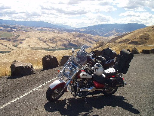
Keep in mind that much of southern Idaho is high desert. It will be cool in the mornings, and can reach 100+ in the afternoons. Carry plenty of water. The road out of Riggins runs next to the river in the bottom of a canyon. Midafternoons through there are like riding in a solar collector.
I would post pics of these routes, but I dont see an easy way to do that. If you have any questions, drop me a line!
Gene Chapman
00 K1200LTC
Highway 21 to Idaho City. From Idaho City to Lowman it gets a bit twisty. Lowman over 7200 ft Banner Summit to Stanley. Left on Highway 75 to Highway 93 to Salmon over Lost Trail summit at 7000 feet north to Lolo, MT, Head west on Highway 12 and the famous "Curves next 77 miles" road. Highway 12 will take you into Lewiston. 95 north on the Idaho side to Coeur d' Alene, i-90 into Spokane. Or 195 north right into Spokane.
For those is a hurry, leave Boise on Highway 55 through Horseshoe Bend, McCall, New Meadows where you connect with Highway 95 through the Riggins canyon. When you reach White Bird, you have two options, Up the highway hugging the side of the hills, or through the town of Whitebird and up the old highway with its 78 hairpin turns in just a couple of miles. This was the original roadway until the early 80s. It reminds me a lot of the switchback roads of Europe. You connect back up with Highway 95 at the top of the hill. When you reach Grangeville, head into town and take Highway 13 into Kooskie. Another wonderful twisty road. Be cautious on the early part of 13. The road is old and the center is higher than the outer edges. You will grind off metal if you are going through the left handers at a high rate of speed. Head west on Highway 12, yes the same one that comes down from Lolo. This route follows a river into Lewiston. It helps keep the temps down a few degrees over the direct Grangeville to Lewiston route.
Keep in mind that much of southern Idaho is high desert. It will be cool in the mornings, and can reach 100+ in the afternoons. Carry plenty of water. The road out of Riggins runs next to the river in the bottom of a canyon. Midafternoons through there are like riding in a solar collector.
I would post pics of these routes, but I dont see an easy way to do that. If you have any questions, drop me a line!
Gene Chapman
00 K1200LTC
 I know you said "S" curves, but come on man that looks like way too much fun!