• Welcome, Guest! We hope you enjoy the excellent technical knowledge, event information and discussions that the BMW MOA forum provides. Some forum content will be hidden from you if you remain logged out. If you want to view all content, please click the 'Log in' button above and enter your BMW MOA username and password.

    If you are not an MOA member, why not take the time to join the club, so you can enjoy posting on the forum, the BMW Owners News magazine, and all of the discounts and benefits the BMW MOA offers?

  • Beginning April 1st, and running through April 30th, there is a new 2024 BMW MOA Election discussion area within The Club section of the forum. Within this forum area is also a sticky post that provides the ground rules for participating in the Election forum area. Also, the candidates statements are provided. Please read before joining the conversation, because the rules are very specific to maintain civility.

    The Election forum is here: Election Forum

Day trips

r65_steve

Member
When I went to the Rally in TN, they had day trips figured out that you could load into your GPS. Will you all be doing that again?
I worked out a ride or two on Google maps, but curious to see what roads/places I might be missing. My goal (if there is such a thing on vacation) is to get out early for a few hours and spend the rest of the day lounging or volunteering around the rally.

We all like twisty roads, so I found some of that east of the Rally. I have never been to KS, so I thought I would plot a route to touch pavement there and maybe OK, but it doesn't look all that "exciting".

Suggestions?
 
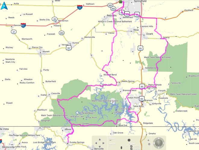
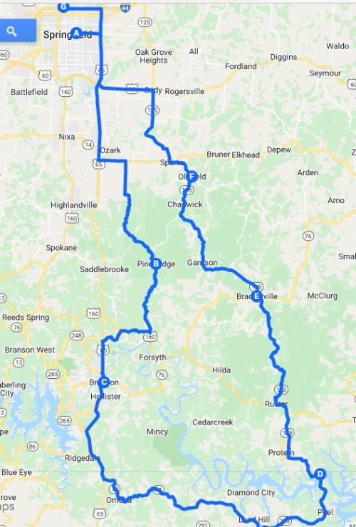
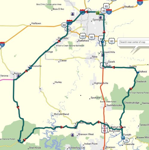
Gee your question isn't getting much response here. Odd. Here is the loop we plan to do. We based it on the rating given highway 76 by Butler Motorcycle Maps.

Ozark Loop.jpg
 
Back when the BMW MOA Foundation was still putting on Camp GEARS for young/new riders at the national rallies, some of our most fun sessions were "Trip Planning". We used paper maps, GPS units, and mapping programs including Google Maps. We also used weather programs/apps and one year we even included a couple of State "construction status" web sites to add chaos and confusion. We posed as problems long trips and short sightseeing day trips too. We talked about routing fastest as well as "most fun" as criteria. Each student was charged with marking their preferred routes on paper maps, or in the case of cross-country trips their routing including highway numbers and via towns or cities. The kids loved it and I am pretty sure they learned a lot.
 
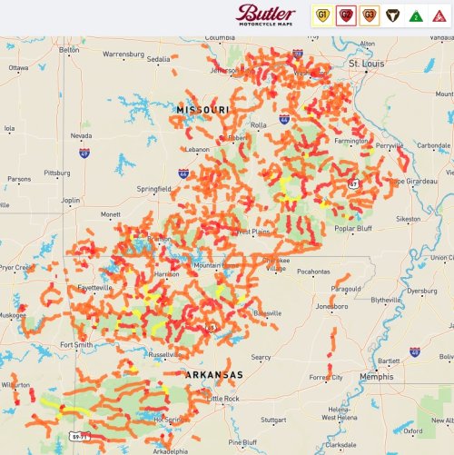
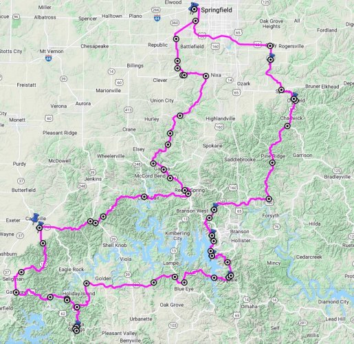
I was working on a route similar to RadioFlyer, still finalizing details but some similar roads trying to hit some of the 1,2,3 rated roads by Butler Maps down south of Springfield, lunch in Eureka Springs, AR and about 250 miles total. Lots of good roads in this area within a short distance from Springfield, MO.

MOA Rally Ride.jpg

Butler.jpg
 
I was working on a route similar to RadioFlyer, still finalizing details but some similar roads trying to hit some of the 1,2,3 rated roads by Butler Maps down south of Springfield, lunch in Eureka Springs, AR and about 250 miles total. Lots of good roads in this area within a short distance from Springfield, MO.

View attachment 88024

View attachment 88025

Good News

Speaking of good roads, highway 187 thru beaver and over the golden gate bridge of the ozarks just north of eureka Springs has NEW pavement, not the chip and seal type, asphalt pavement. It is a winding scenic narrow road thru a pretty valley and is highly recommended. the bridge is a great photo op.


This road was full of cracks, loose edges, chugholes and hard to ride with any speed, just pretty. Now with great pavement.

Eureka Springs has Bubba BBQ, several bike themed eating places and the Mud Street Cafe, not to be missed IMHO. maybe just lucky bet the high gas prices seemed to be reducing motor homes clogging the wonderful 15 MPH turns so those inclined can enjoy the lean and the g force.

most of the pig trail pavement survived winter and is a great ride. Now the OARK General Store has ample covered outdoor seating.

Rod


Rod
 
Speaking of good roads, highway 187 thru beaver and over the golden gate bridge of the ozarks just north of eureka Springs has NEW pavement, not the chip and seal type, asphalt pavement. It is a winding scenic narrow road thru a pretty valley and is highly recommended. the bridge is a great photo op.


Rod

I noticed his route took him close to Beaver. 187 over the bridge, then 62 into Eureka would be a good route.

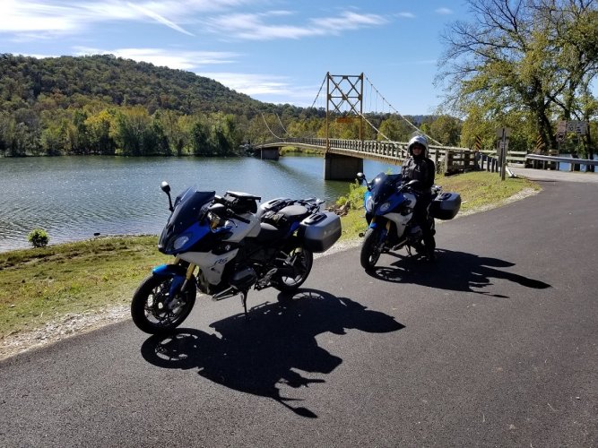
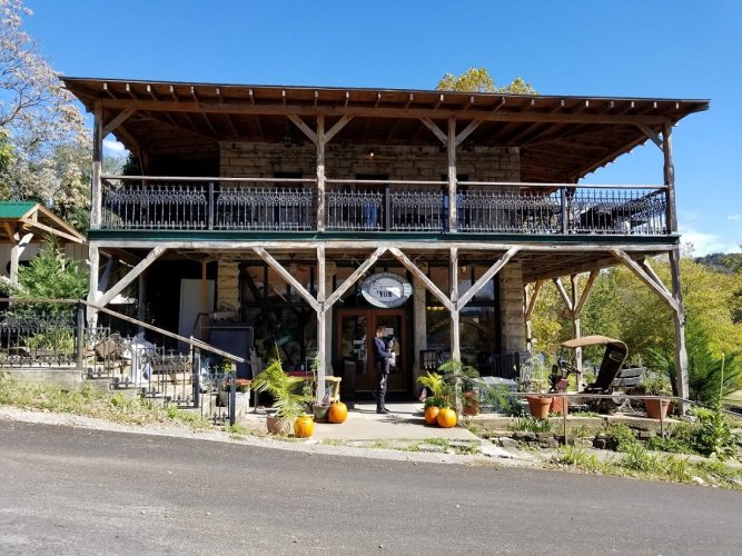
Beaver Bridge and store.
20171017_114811.jpg

20171017_115559.jpg


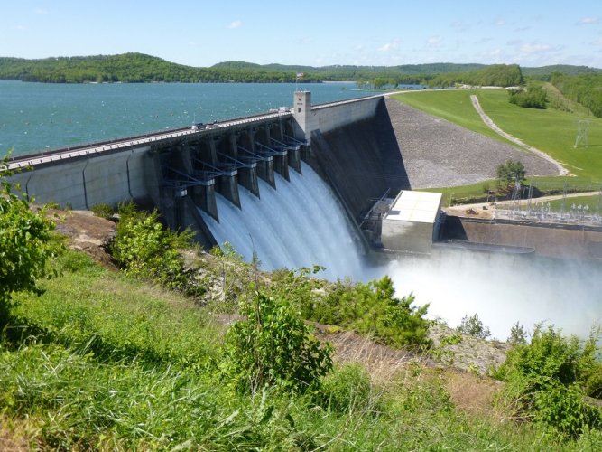
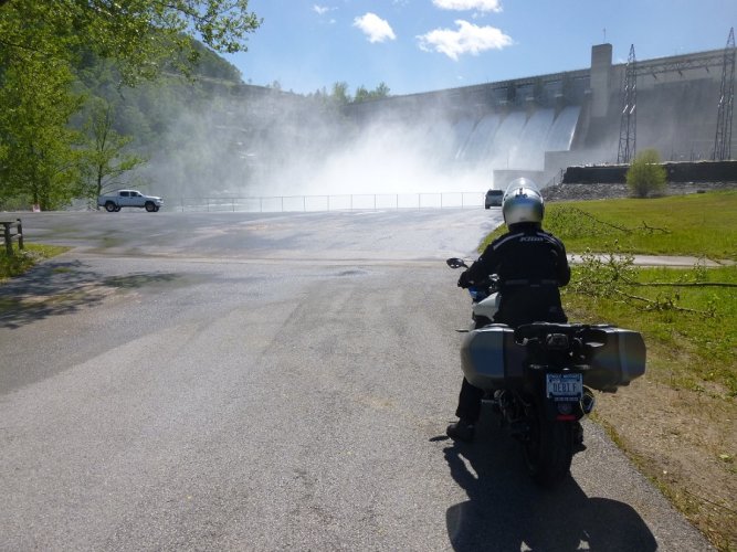
Beaver Dam
Beaver Dam (1).JPG

Beaver Dam (2).JPG
 
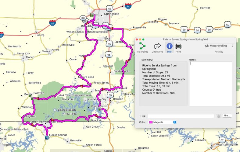
So I modified my route after some review and the recommendation from Lee to cross Beaver Bridge and some food recommendations from Darrell in Eureka Springs. My route is going to go counterclockwise so I do cross Beaver Bridge but don't take 62 into Eureka Springs. This route is 255 miles starting at Casey's in Springfield, MO, about 6 hours of riding time and 7.5-8 hours total depending on your stops. with a 9am start that puts you in Eureka Springs about 12:30pm for lunch and back to Springfield, MO about 4:30-5pm. I guess it depends on your riding style, stops, etc. but this allows for 2 stops and an hour lunch stop. I'll provide GPX files for route and open to any suggestions. I tried to hit as many Butler rated roads as possible yet trying to keep the distance close to 250 miles and the total time to about 8-9 hours total. With more stops you could plan to leave earlier or return later. I figured on maybe a Saturday ride to get back in time for closing ceremonies at Rally.

https://go.rever.co/54wa4lgZsqb

https://drive.google.com/file/d/1Vt75GEiZ_T0HI_LVptvM-K4-jyZ9V4-X/view?usp=sharing

Ride to Eureka Springs from MOA.jpg
 
Last edited:
So I modified my route after some review and the recommendation from Lee to cross Beaver Bridge and some food recommendations from Darrell in Eureka Springs. My route is going to go counterclockwise so I do cross Beaver Bridge but don't take 62 into Eureka Springs.

37 south out of Cassville is fairly straight and flat. 112 south out of Casssville going past Roaring River State Park might be a better option.
 
OK, thanks, I did revise route based on this suggestion. Modified to take 112 and added gas stop along route rather than go into Cassville. Looking at topography the road is much better and not as flat as suggested. Altered the links and image in above post. Thanks Lee!

37 south out of Cassville is fairly straight and flat. 112 south out of Casssville going past Roaring River State Park might be a better option.

Rally Day Ride Topo.jpg
 
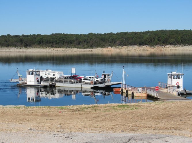
Thanks for bumping this up. I need to revisit some of the maps I made in Google/Basecamp. There's some kind of free ferry in AR that I was going to cross. Lemme see if I can find that again.
 
Thanks for bumping this up. I need to revisit some of the maps I made in Google/Basecamp. There's some kind of free ferry in AR that I was going to cross. Lemme see if I can find that again.

Peel Ferry crosses Bull Shoals Lake. Hwy 125
IMG_0581.JPG
 
...I have never been to KS, so I thought I would plot a route to touch pavement there and maybe OK, but it doesn't look all that "exciting".

Suggestions?
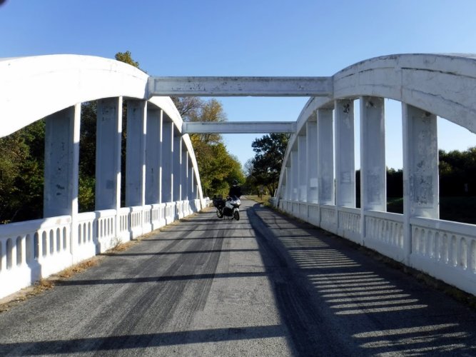
The Rainbow Bridge west of Joplin on Route 66 is a nice stop if you are interested in old bridges. We've been there a few times, picking up old Route 66 side roads along the way.
Rainbow Bridge.JPG
 
The Rainbow Bridge west of Joplin on Route 66 is a nice stop if you are interested in old bridges. We've been there a few times, picking up old Route 66 side roads along the way.
View attachment 88049

Looks like I could use up the rest of my rear tire there as well! I'm also planning a day where I go touch pavement in KS and OK, cause I never have so I will add this to the punch list.
 
You can download a GPX from this site...

<iframe src="https://ridewithgps.com/embeds?type=route&id=39573377&sampleGraph=true" style="width: 1px; min-width: 100%; height: 900px; border: none;" scrolling="no"></iframe>
 
Day Rides

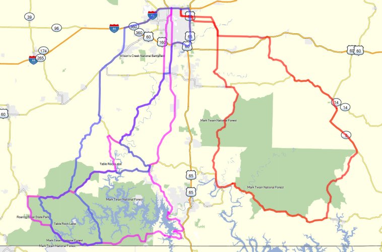
Here are 3 day rides that I made up (based on Butler maps and other ideas found online)... the gpx tracks are attached

MO-routes.jpg
 

Attachments

  • MO #1 174_4_30.gpx
    180.8 KB · Views: 16
  • MO #2 188_5_20.gpx
    210.6 KB · Views: 15
  • MO #3 179_3_53.gpx
    650.3 KB · Views: 15
Last edited:
My family owned a ranch near Bull Shoals Lake in MO. It will not be hard to find twisty roads in that part of MO since many of the roads follow ridge lines. US Hwy 160 is an example. It probably doesn't have a straight section longer then a mile in the western part of the State. MO Rt 95 is very similar also.
 
Went to visit my uncle in Boston on Friday.
IMG_6872-XL.jpg
 
Back
Top