• Welcome, Guest! We hope you enjoy the excellent technical knowledge, event information and discussions that the BMW MOA forum provides. Some forum content will be hidden from you if you remain logged out. If you want to view all content, please click the 'Log in' button above and enter your BMW MOA username and password.

    If you are not an MOA member, why not take the time to join the club, so you can enjoy posting on the forum, the BMW Owners News magazine, and all of the discounts and benefits the BMW MOA offers?

  • Beginning April 1st, and running through April 30th, there is a new 2024 BMW MOA Election discussion area within The Club section of the forum. Within this forum area is also a sticky post that provides the ground rules for participating in the Election forum area. Also, the candidates statements are provided. Please read before joining the conversation, because the rules are very specific to maintain civility.

    The Election forum is here: Election Forum

Riding to our 50th Anniversary Rally

Visian

look out!!!
Now that the MOA has done something with Ride With GPS (not sure what, but it's something....) I thought maybe we could try a different spin on route sharing stuff that's been done in the past... a forum thread where we can embed routes route and GPS files. You can create the maps at Ride with GPS and embed them here. This can also help us better archive this information for the future. I strongly encourage you to start a free Ride with GPS account so that you can embed routes here... they're more graphic than .gpx attachments. RWGPS is definitely worth paying for, too.

This ride starts with awesome hamburgers at the Oark Cafe in Oark, Arkansas. It then winds through some hollers, up the Pig Trail and then back roads all the way to Springfield. I am pretty sure it's all paved. I sure hope the cafe is still open! :ha

IMG_3620-X3.jpg


Here's the map... the ride is 177 miles, should take you the rest of the afternoon to get to the rally.

And.... in true "MOA Posse" style, it would be cool if some people met there for lunch on Wednesday, June 15th and then rode to the rally together. :thumb


<iframe src="https://ridewithgps.com/embeds?type=route&id=38865077&sampleGraph=true" style="width: 1px; min-width: 100%; height: 900px; border: none;" scrolling="no"></iframe>


I would very much like to thank Adam Chandler for making a public/open request to the membership for volunteers. Good on ya, mate!
 
Last edited:
Sutton Bluff - for campers and dirt road riders

Here's another suggested ride, 200 miles of mostly paved but some nice graded dirt/gravel forest service roads thrown in. And a pretty darn nice primitive (bathrooms, group shelter/tables... showers, it's been a while since I've been there... here is the info page) campground to start from.

Sutton Bluff is just SW from St. Louis. Just checked with the Mark Twain National Forest people and it opens today for the season. You can book a site at Recreation.gov but they keep half the place open first-come, first serve. One campsite can hold several tents... the group site is really nice.

And.... in true "MOA Posse" style, it would be cool if some people met and camped out together there on Wednesday, June 15th and then ride to the rally. :thumb

<iframe src="https://ridewithgps.com/embeds?type=route&id=38876253&sampleGraph=true" style="width: 1px; min-width: 100%; height: 900px; border: none;" scrolling="no"></iframe>
 
Last edited:
Our timing is off just a tad…and your routes are a bit too straight for my liking. 😝

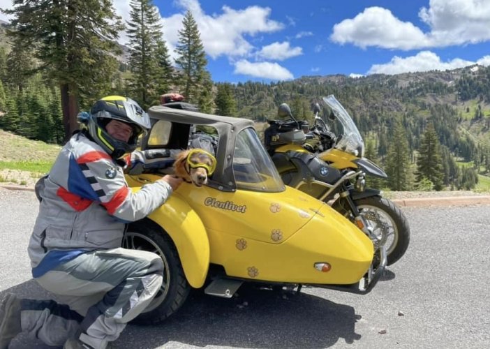
Glenlivet and I will pass through Cape Girardeau on the afternoon of the 11th looking for a place to camp. We’ll likely head to Sam Baker SP given the time of day. We’ll pass by Sutton Bluff the following day as part of our usual meandering style of travel, but will likely end up somewhere around Alley Spring west of Eminence. Then into northern Arkansas covering 400 road miles (but just 65 as the crow flies), hitting Oark for lunch on the 15th before a couple of loops ending around Ponca or Jasper. Then up to the Peel Ferry into Missouri and the rally.

Hope to see plenty of friends old and new along the way!

A61F2079-D352-4429-9054-B5C638060A1D.jpeg
 

I find it easier to read your map if I change the map view from RWGPS to Map in the upper right corner.
The Map view labels more of the roads.

Thanks for posting map that let us zoom in and out.
Looks like a nice tool for posting maps on forums.
 
I find it easier to read your map if I change the map view from RWGPS to Map in the upper right corner.
The Map view labels more of the roads.

Thanks for posting map that let us zoom in and out.
Looks like a nice tool for posting maps on forums.

If I have this right, the “Map” is Google Maps, which RWGPS pays for. The RWGPS is a public domain/open map source, I bet. I haven’t followed this area of tech for a few years now.

Ride With GPS was started a number of years ago by two young fellows in college. They used to answer their support requests personally. :)

I am not sure what the MOA is doing with them… I am following to see what happens. But I can tell you that a paying membership with these guys is worth the money. They’ve mainly been chasing the bicycle market, but I hope they continue adding features that are useful for anyone on two wheels.

Please give them a try!

Ian
 
If I have this right, the “Map” is Google Maps,

Ian

Yes, Map appears to be Google Maps.
I tried Ride with GPS a couple years ago and didn't like it for some reason.
I played with it last night and it seems easy to use.
I need to make some routes and see how well that works for loading to a GPS.

I didn't mean to get off topic but thought people would like to know about the Map option so they can see more highway numbers.
 
Did you see the OP? Maybe some peeps will meet you in Oark for a hamburger.

Peel's Ferry was a GS BS point in the 2012 GS Giant... riding from just west of Oark up to Sedalia.

I saw that, but I have no plans to go straight to the rally from there with so many awesome roads and places to camp between the two points!
 
I saw that, but I have no plans to go straight to the rally from there with so many awesome roads and places to camp between the two points!

In all my years of doing this I've found that 99.9% of people want a fairly direct-ish route, typically because they don't have that much time.
 
In all my years of doing this I've found that 99.9% of people want a fairly direct-ish route, typically because they don't have that much time.

You’ve figured out why I ride solo! I inevitably fall for the “Where’s that road go?” syndrome
 
Loess Hills, south of Sioux City

This is a splendid alternative to an incredibly boring section of I-29. Beautiful rolling hills riding in Iowa. Some years ago, The GS Giants used this as an Adventure Detour™ and if you're interested there are a lot of dirt section alternatives... see those green areas in the middle... but this route is all paved.

There are sections of this road south of Omaha, but I didn't include them. Here is the entire route if you'd like to expand upon this route.

<iframe src="https://ridewithgps.com/embeds?type=route&id=38996145&sampleGraph=true" style="width: 1px; min-width: 100%; height: 900px; border: none;" scrolling="no"></iframe>
 
Highway 103 south from Oark is a good ride. Then you can go across to old highway 71 just for good old times or pick up the pig trail again at Ozark.

Rod
 
We'll be on 23 in a few days on our way to Texas.

I think Pete is planning on Oark and 23.

Yup. 7 and 123 south to Clarksville then looping back up to Oark then 23 north and east to the Ponga and Jasper area. We’ll probably reach the rally midday Thursday unless we find another road demanding our attention
 
Yup. 7 and 123 south to Clarksville then looping back up to Oark then 23 north and east to the Ponga and Jasper area. We’ll probably reach the rally midday Thursday unless we find another road demanding our attention

It's easy to get distracted by good roads in NW Arkansas :)
 
Talimena Byway and squiggly lines north

This route is a good long day's ride, 366 miles of country roads, and a great option for those riding from Dallas, TX and surrounds. Worth the short jaunt south of I-40 to ride the Talimena Scenic Byway...

To see a better view of the road numbers, use the pull-down menu in the upper right of the map to select "Map"

Note: there are some sweet dirt road alternatives to this route..."adventure detours" .... :evil

<iframe src="https://ridewithgps.com/embeds?type=route&id=39021259&sampleGraph=true" style="width: 1px; min-width: 100%; height: 900px; border: none;" scrolling="no"></iframe>
 
Back
Top