C
criminaldesign
Guest
WV Podunk ride #2
March 6-8
Route: Rt 2, 35, 93, I64, 119, 1, 3 and 34
Weather: Blue skys, all around me
Map:
<table style="width:auto;"><tr><td><a href="http://picasaweb.google.com/lh/photo/Ai2p_aCSBwSsLA6f4LsGUA?feat=embedwebsite"><img src="http://lh3.ggpht.com/_QUlLxCsQNp0/S5VhJSBkCUI/AAAAAAAABrM/f3deHzTvuVY/s800/Map.jpg" /></a></td></tr><tr><td style="font-family:arial,sans-serif; font-size:11px; text-align:right">From <a href="http://picasaweb.google.com/houstonmcintyre/PtPleasant?feat=embedwebsite">Pt. Pleasant</a></td></tr></table>
Wow, the weather couldn't have been better, time to get the bike back out. Getting stuff prepared, I open a saddle bag and the hinge busts. I go inside and order 4 hinges from Bob's, go back out, take off the bags and ride nekkid.
This time I opt for Rt2 towards Pt Pleasant wanting to hit up the ammo bunkers again in the hills. Supposably this is where the Mothman hangs out. It's a pretty cool spot. Back in the war years, the Gov put in an ammunition factory, there's scant reminders throughout the grounds of ammo bunkers and buildings, which is now a wildlife area.
From Pt. Pleasant I cross the bridge that replaced the Silver Bridge, the one that fell in the 60's. I shot west on 35 for about 15 miles and hung a left a Rio Grande, which is the spot of Bob Evan's farms and the first diner.
Here things get a bit sketchy on my route. I had no map on me (removed the bags) and I only had a vague idea of where to go anyway. I meant to go south, and I knew I should have turned a left back a few miles but stay straight (west) and enjoy the empty 2 lane. I end up in Oakhill. Oakhill is probably 10 miles west of Rio Grande on 35. I really took the long way. No biggie. Shoot south on 93 in Oakhill and I'm back on track towards Ironton, OH.
I ride through Ironton, cross the bridge into Ashland, KY and hit up the interstate 64 to my Aunts in Dunbar, WV. Fried chicken is for dinner and I like my fried chicken and call it a night. Funny thing is, my last ride I got a fried chicken dinner out of it.
Next morning, wake up and hit the road before 8am and went south on 119 to Logan, WV. The Hatfield and McCoy ATV trail is all over the place, Crosses 119 in multiple spots.
Man how some people live. Thought the section 8 was bad in the city? Check out some parts in southern WV and eastern KY. Not one to tramp on what people do, but it blows my mind. Whatever...
But regardless of the local yards, Rt10 from Logan to Hamlin was a fabulous ride with the Guyandote River to the right and not a cloud in the sky. 10 turned out to be a great road with tight turns going up and down and over and around the mountains. From 10, I take 3 for a few miles and hit up rt 34 which took me back to my aunts. Woke up and was back on the road at 8 this morning to be back at the dining table just in time for work.
Planning on Atlanta next week...
Pix...
Gates to ammo bunkers off of the road. There's 6 pull offs I think. IF you didn't know the bunkers are there, you would go right by.
<table style="width:auto;"><tr><td><a href="http://picasaweb.google.com/lh/photo/wRqJk4B9P63TLmDp8BzrMA?feat=embedwebsite"><img src="http://lh4.ggpht.com/_QUlLxCsQNp0/S5VdZXCVRAI/AAAAAAAABpg/0WrBbftaMfc/s800/DSCF1302.jpg" /></a></td></tr><tr><td style="font-family:arial,sans-serif; font-size:11px; text-align:right">From <a href="http://picasaweb.google.com/houstonmcintyre/PtPleasant?feat=embedwebsite">Pt. Pleasant</a></td></tr></table>
Behind the gates maybe 50 yards down, a bunch of brush. Notice the 'thicker' area of brush.
<table style="width:auto;"><tr><td><a href="http://picasaweb.google.com/lh/photo/xNl_sTR6cWXNH1wThVo1nw?feat=embedwebsite"><img src="http://lh4.ggpht.com/_QUlLxCsQNp0/S5VdeGYqNEI/AAAAAAAABpo/ER9QDeupbh4/s800/DSCF1304.jpg" /></a></td></tr><tr><td style="font-family:arial,sans-serif; font-size:11px; text-align:right">From <a href="http://picasaweb.google.com/houstonmcintyre/PtPleasant?feat=embedwebsite">Pt. Pleasant</a></td></tr></table>
Ammo bunker is what's under the brush. These are all shut and locked up. Used to be able to go inside. Hard to tell how many of these are out there.
<table style="width:auto;"><tr><td><a href="http://picasaweb.google.com/lh/photo/Frx06WXYWmLi1GRf_RhTuw?feat=embedwebsite"><img src="http://lh5.ggpht.com/_QUlLxCsQNp0/S3l5TYiS3rI/AAAAAAAABoQ/QRW3ydv1Yjg/s800/PtPleasant2.jpg" /></a></td></tr><tr><td style="font-family:arial,sans-serif; font-size:11px; text-align:right">From <a href="http://picasaweb.google.com/houstonmcintyre/Random?feat=embedwebsite">Random</a></td></tr></table>
Gratuitous shot...
<table style="width:auto;"><tr><td><a href="http://picasaweb.google.com/lh/photo/Ief6DlzPObDB0fUGfKM-9g?feat=embedwebsite"><img src="http://lh3.ggpht.com/_QUlLxCsQNp0/S5VdbVvY7iI/AAAAAAAABpk/VjVWgItPW-I/s800/DSCF1303.jpg" /></a></td></tr><tr><td style="font-family:arial,sans-serif; font-size:11px; text-align:right">From <a href="http://picasaweb.google.com/houstonmcintyre/PtPleasant?feat=embedwebsite">Pt. Pleasant</a></td></tr></table>
What's left of the ammo mill. The fence hasn't been there all that long.
<table style="width:auto;"><tr><td><a href="http://picasaweb.google.com/lh/photo/eC_dZmIn5-jF3qN7dNV9-w?feat=embedwebsite"><img src="http://lh5.ggpht.com/_QUlLxCsQNp0/S5VdlgT9ZWI/AAAAAAAABp0/SW7JtnLVk6o/s800/DSCF1307.jpg" /></a></td></tr><tr><td style="font-family:arial,sans-serif; font-size:11px; text-align:right">From <a href="http://picasaweb.google.com/houstonmcintyre/PtPleasant?feat=embedwebsite">Pt. Pleasant</a></td></tr></table>
It's a decent size loop. Ammo bunkers on the north road, factory on the south and roads cutting through the middle. Here's the middle...
<table style="width:auto;"><tr><td><a href="http://picasaweb.google.com/lh/photo/yhOh2ApAjVqf2zpohyj8kg?feat=embedwebsite"><img src="http://lh3.ggpht.com/_QUlLxCsQNp0/S5VdoJEJhKI/AAAAAAAABp4/rQroZS98_2Q/s800/DSCF1308.jpg" /></a></td></tr><tr><td style="font-family:arial,sans-serif; font-size:11px; text-align:right">From <a href="http://picasaweb.google.com/houstonmcintyre/PtPleasant?feat=embedwebsite">Pt. Pleasant</a></td></tr></table>
Welcome to Chemical Valley. Dime a dozen.
<table style="width:auto;"><tr><td><a href="http://picasaweb.google.com/lh/photo/HIbmjLQFlj-aSDjBxqPuMQ?feat=embedwebsite"><img src="http://lh3.ggpht.com/_QUlLxCsQNp0/S5Vdp2mqgBI/AAAAAAAABp8/dxYCKAzlII8/s800/DSCF1309.jpg" /></a></td></tr><tr><td style="font-family:arial,sans-serif; font-size:11px; text-align:right">From <a href="http://picasaweb.google.com/houstonmcintyre/PtPleasant?feat=embedwebsite">Pt. Pleasant</a></td></tr></table>
Down by the point where the kanawha and the mighty ohio meet is the heritage part of town. There's been a project of the murals being painted on the flood walls. Maybe 10 panels so far and I have to say they are executed pretty well. This is Chief Cornstalk, see a bit of the mural in the background.
<table style="width:auto;"><tr><td><a href="http://picasaweb.google.com/lh/photo/ifGQufRr7Rgj0ow2GWiK6w?feat=embedwebsite"><img src="http://lh5.ggpht.com/_QUlLxCsQNp0/S5VdwEKTmJI/AAAAAAAABqI/AYum8MeXtFI/s800/DSCF1312.jpg" /></a></td></tr><tr><td style="font-family:arial,sans-serif; font-size:11px; text-align:right">From <a href="http://picasaweb.google.com/houstonmcintyre/PtPleasant?feat=embedwebsite">Pt. Pleasant</a></td></tr></table>
Lordy Dunmore
<table style="width:auto;"><tr><td><a href="http://picasaweb.google.com/lh/photo/sly9Lxs_PcKtVXvWrbkvxw?feat=embedwebsite"><img src="http://lh3.ggpht.com/_QUlLxCsQNp0/S5Vdy7jaIbI/AAAAAAAABqM/6nTP1aHi-MA/s800/DSCF1313.jpg" /></a></td></tr><tr><td style="font-family:arial,sans-serif; font-size:11px; text-align:right">From <a href="http://picasaweb.google.com/houstonmcintyre/PtPleasant?feat=embedwebsite">Pt. Pleasant</a></td></tr></table>
Mural detail. Mind you each panel is maybe 15 feet tall and 20 feet wide.
<table style="width:auto;"><tr><td><a href="http://picasaweb.google.com/lh/photo/TSteTHmiju_DTNnWmQcBdA?feat=embedwebsite"><img src="http://lh3.ggpht.com/_QUlLxCsQNp0/S5Vd1f7QsbI/AAAAAAAABqQ/9h_qFi4rscc/s800/DSCF1314.jpg" /></a></td></tr><tr><td style="font-family:arial,sans-serif; font-size:11px; text-align:right">From <a href="http://picasaweb.google.com/houstonmcintyre/PtPleasant?feat=embedwebsite">Pt. Pleasant</a></td></tr></table>
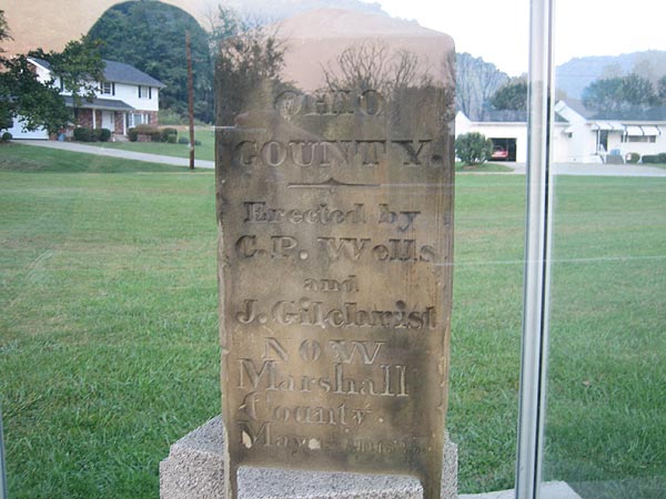
History. Flood wall in background
<table style="width:auto;"><tr><td><a href="http://picasaweb.google.com/lh/photo/x2hkEh6-shd6KMqq7W5hSw?feat=embedwebsite"><img src="http://lh6.ggpht.com/_QUlLxCsQNp0/S5Vd4fV_rNI/AAAAAAAABqU/fuQcAa_BRXU/s800/DSCF1316.jpg" /></a></td></tr><tr><td style="font-family:arial,sans-serif; font-size:11px; text-align:right">From <a href="http://picasaweb.google.com/houstonmcintyre/PtPleasant?feat=embedwebsite">Pt. Pleasant</a></td></tr></table>
Cool monument in the river park
<table style="width:auto;"><tr><td><a href="http://picasaweb.google.com/lh/photo/MIHFXbvOhzh1yzFIFAMoTw?feat=embedwebsite"><img src="http://lh4.ggpht.com/_QUlLxCsQNp0/S5Vd6qIoyaI/AAAAAAAABqY/ppH82cMyj7E/s800/DSCF1317.jpg" /></a></td></tr><tr><td style="font-family:arial,sans-serif; font-size:11px; text-align:right">From <a href="http://picasaweb.google.com/houstonmcintyre/PtPleasant?feat=embedwebsite">Pt. Pleasant</a></td></tr></table>
Next day on 119 to Logan...
Coal, the blood of WV.
<table style="width:auto;"><tr><td><a href="http://picasaweb.google.com/lh/photo/YBGVYNUDaS6_GR9nSwBXZw?feat=embedwebsite"><img src="http://lh6.ggpht.com/_QUlLxCsQNp0/S5VeAWRneyI/AAAAAAAABqo/hRGtsvAHM0I/s800/DSCF1323.jpg" /></a></td></tr><tr><td style="font-family:arial,sans-serif; font-size:11px; text-align:right">From <a href="http://picasaweb.google.com/houstonmcintyre/PtPleasant?feat=embedwebsite">Pt. Pleasant</a></td></tr></table>
Hey there's ol' chief again. Chief Cornstalk SP. Nice park.
<table style="width:auto;"><tr><td><a href="http://picasaweb.google.com/lh/photo/xGPXvlc5LceNce13Q2GJVg?feat=embedwebsite"><img src="http://lh5.ggpht.com/_QUlLxCsQNp0/S5VeHGRTYMI/AAAAAAAABqw/ucL59WW8Efo/s800/DSCF1331.jpg" /></a></td></tr><tr><td style="font-family:arial,sans-serif; font-size:11px; text-align:right">From <a href="http://picasaweb.google.com/houstonmcintyre/PtPleasant?feat=embedwebsite">Pt. Pleasant</a></td></tr></table>
Maybe 5 feet away. One almost came up to me on the bike, then thought otherwise. 6 altogether.
<table style="width:auto;"><tr><td><a href="http://picasaweb.google.com/lh/photo/h5iuEPBsOrz1WSJJi0zF4w?feat=embedwebsite"><img src="http://lh5.ggpht.com/_QUlLxCsQNp0/S5VeEIov2UI/AAAAAAAABqs/ozJe21PiEN0/s800/DSCF1327.jpg" /></a></td></tr><tr><td style="font-family:arial,sans-serif; font-size:11px; text-align:right">From <a href="http://picasaweb.google.com/houstonmcintyre/PtPleasant?feat=embedwebsite">Pt. Pleasant</a></td></tr></table>
Rode Road
<table style="width:auto;"><tr><td><a href="http://picasaweb.google.com/lh/photo/XhAwDu2iVs-XYN5rCdcB1w?feat=embedwebsite"><img src="http://lh3.ggpht.com/_QUlLxCsQNp0/S5VeJTRc3yI/AAAAAAAABq0/rPOQSoLbJ4Q/s800/DSCF1332.jpg" /></a></td></tr><tr><td style="font-family:arial,sans-serif; font-size:11px; text-align:right">From <a href="http://picasaweb.google.com/houstonmcintyre/PtPleasant?feat=embedwebsite">Pt. Pleasant</a></td></tr></table>
Empty cars
<table style="width:auto;"><tr><td><a href="http://picasaweb.google.com/lh/photo/ZSn-ZkvTQHUHzWAJUQNF2g?feat=embedwebsite"><img src="http://lh6.ggpht.com/_QUlLxCsQNp0/S5VeP8sdUPI/AAAAAAAABq8/Un92EIEDSUM/s800/DSCF1334.jpg" /></a></td></tr><tr><td style="font-family:arial,sans-serif; font-size:11px; text-align:right">From <a href="http://picasaweb.google.com/houstonmcintyre/PtPleasant?feat=embedwebsite">Pt. Pleasant</a></td></tr></table>
There was a few of these
<table style="width:auto;"><tr><td><a href="http://picasaweb.google.com/lh/photo/07xx8lvzPOSidgnl5pWRVA?feat=embedwebsite"><img src="http://lh3.ggpht.com/_QUlLxCsQNp0/S5VeR0DGqSI/AAAAAAAABrA/0DJklR76gGg/s800/DSCF1337.jpg" /></a></td></tr><tr><td style="font-family:arial,sans-serif; font-size:11px; text-align:right">From <a href="http://picasaweb.google.com/houstonmcintyre/PtPleasant?feat=embedwebsite">Pt. Pleasant</a></td></tr></table>
In the turn...
<table style="width:auto;"><tr><td><a href="http://picasaweb.google.com/lh/photo/318N9Ld8cguarNr76ni8Lg?feat=embedwebsite"><img src="http://lh3.ggpht.com/_QUlLxCsQNp0/S5VeTtxHbvI/AAAAAAAABrE/khNKcdVdTNk/s800/DSCF1338.jpg" /></a></td></tr><tr><td style="font-family:arial,sans-serif; font-size:11px; text-align:right">From <a href="http://picasaweb.google.com/houstonmcintyre/PtPleasant?feat=embedwebsite">Pt. Pleasant</a></td></tr></table>
March 6-8
Route: Rt 2, 35, 93, I64, 119, 1, 3 and 34
Weather: Blue skys, all around me
Map:
<table style="width:auto;"><tr><td><a href="http://picasaweb.google.com/lh/photo/Ai2p_aCSBwSsLA6f4LsGUA?feat=embedwebsite"><img src="http://lh3.ggpht.com/_QUlLxCsQNp0/S5VhJSBkCUI/AAAAAAAABrM/f3deHzTvuVY/s800/Map.jpg" /></a></td></tr><tr><td style="font-family:arial,sans-serif; font-size:11px; text-align:right">From <a href="http://picasaweb.google.com/houstonmcintyre/PtPleasant?feat=embedwebsite">Pt. Pleasant</a></td></tr></table>
Wow, the weather couldn't have been better, time to get the bike back out. Getting stuff prepared, I open a saddle bag and the hinge busts. I go inside and order 4 hinges from Bob's, go back out, take off the bags and ride nekkid.
This time I opt for Rt2 towards Pt Pleasant wanting to hit up the ammo bunkers again in the hills. Supposably this is where the Mothman hangs out. It's a pretty cool spot. Back in the war years, the Gov put in an ammunition factory, there's scant reminders throughout the grounds of ammo bunkers and buildings, which is now a wildlife area.
From Pt. Pleasant I cross the bridge that replaced the Silver Bridge, the one that fell in the 60's. I shot west on 35 for about 15 miles and hung a left a Rio Grande, which is the spot of Bob Evan's farms and the first diner.
Here things get a bit sketchy on my route. I had no map on me (removed the bags) and I only had a vague idea of where to go anyway. I meant to go south, and I knew I should have turned a left back a few miles but stay straight (west) and enjoy the empty 2 lane. I end up in Oakhill. Oakhill is probably 10 miles west of Rio Grande on 35. I really took the long way. No biggie. Shoot south on 93 in Oakhill and I'm back on track towards Ironton, OH.
I ride through Ironton, cross the bridge into Ashland, KY and hit up the interstate 64 to my Aunts in Dunbar, WV. Fried chicken is for dinner and I like my fried chicken and call it a night. Funny thing is, my last ride I got a fried chicken dinner out of it.
Next morning, wake up and hit the road before 8am and went south on 119 to Logan, WV. The Hatfield and McCoy ATV trail is all over the place, Crosses 119 in multiple spots.
Man how some people live. Thought the section 8 was bad in the city? Check out some parts in southern WV and eastern KY. Not one to tramp on what people do, but it blows my mind. Whatever...
But regardless of the local yards, Rt10 from Logan to Hamlin was a fabulous ride with the Guyandote River to the right and not a cloud in the sky. 10 turned out to be a great road with tight turns going up and down and over and around the mountains. From 10, I take 3 for a few miles and hit up rt 34 which took me back to my aunts. Woke up and was back on the road at 8 this morning to be back at the dining table just in time for work.
Planning on Atlanta next week...
Pix...
Gates to ammo bunkers off of the road. There's 6 pull offs I think. IF you didn't know the bunkers are there, you would go right by.
<table style="width:auto;"><tr><td><a href="http://picasaweb.google.com/lh/photo/wRqJk4B9P63TLmDp8BzrMA?feat=embedwebsite"><img src="http://lh4.ggpht.com/_QUlLxCsQNp0/S5VdZXCVRAI/AAAAAAAABpg/0WrBbftaMfc/s800/DSCF1302.jpg" /></a></td></tr><tr><td style="font-family:arial,sans-serif; font-size:11px; text-align:right">From <a href="http://picasaweb.google.com/houstonmcintyre/PtPleasant?feat=embedwebsite">Pt. Pleasant</a></td></tr></table>
Behind the gates maybe 50 yards down, a bunch of brush. Notice the 'thicker' area of brush.
<table style="width:auto;"><tr><td><a href="http://picasaweb.google.com/lh/photo/xNl_sTR6cWXNH1wThVo1nw?feat=embedwebsite"><img src="http://lh4.ggpht.com/_QUlLxCsQNp0/S5VdeGYqNEI/AAAAAAAABpo/ER9QDeupbh4/s800/DSCF1304.jpg" /></a></td></tr><tr><td style="font-family:arial,sans-serif; font-size:11px; text-align:right">From <a href="http://picasaweb.google.com/houstonmcintyre/PtPleasant?feat=embedwebsite">Pt. Pleasant</a></td></tr></table>
Ammo bunker is what's under the brush. These are all shut and locked up. Used to be able to go inside. Hard to tell how many of these are out there.
<table style="width:auto;"><tr><td><a href="http://picasaweb.google.com/lh/photo/Frx06WXYWmLi1GRf_RhTuw?feat=embedwebsite"><img src="http://lh5.ggpht.com/_QUlLxCsQNp0/S3l5TYiS3rI/AAAAAAAABoQ/QRW3ydv1Yjg/s800/PtPleasant2.jpg" /></a></td></tr><tr><td style="font-family:arial,sans-serif; font-size:11px; text-align:right">From <a href="http://picasaweb.google.com/houstonmcintyre/Random?feat=embedwebsite">Random</a></td></tr></table>
Gratuitous shot...
<table style="width:auto;"><tr><td><a href="http://picasaweb.google.com/lh/photo/Ief6DlzPObDB0fUGfKM-9g?feat=embedwebsite"><img src="http://lh3.ggpht.com/_QUlLxCsQNp0/S5VdbVvY7iI/AAAAAAAABpk/VjVWgItPW-I/s800/DSCF1303.jpg" /></a></td></tr><tr><td style="font-family:arial,sans-serif; font-size:11px; text-align:right">From <a href="http://picasaweb.google.com/houstonmcintyre/PtPleasant?feat=embedwebsite">Pt. Pleasant</a></td></tr></table>
What's left of the ammo mill. The fence hasn't been there all that long.
<table style="width:auto;"><tr><td><a href="http://picasaweb.google.com/lh/photo/eC_dZmIn5-jF3qN7dNV9-w?feat=embedwebsite"><img src="http://lh5.ggpht.com/_QUlLxCsQNp0/S5VdlgT9ZWI/AAAAAAAABp0/SW7JtnLVk6o/s800/DSCF1307.jpg" /></a></td></tr><tr><td style="font-family:arial,sans-serif; font-size:11px; text-align:right">From <a href="http://picasaweb.google.com/houstonmcintyre/PtPleasant?feat=embedwebsite">Pt. Pleasant</a></td></tr></table>
It's a decent size loop. Ammo bunkers on the north road, factory on the south and roads cutting through the middle. Here's the middle...
<table style="width:auto;"><tr><td><a href="http://picasaweb.google.com/lh/photo/yhOh2ApAjVqf2zpohyj8kg?feat=embedwebsite"><img src="http://lh3.ggpht.com/_QUlLxCsQNp0/S5VdoJEJhKI/AAAAAAAABp4/rQroZS98_2Q/s800/DSCF1308.jpg" /></a></td></tr><tr><td style="font-family:arial,sans-serif; font-size:11px; text-align:right">From <a href="http://picasaweb.google.com/houstonmcintyre/PtPleasant?feat=embedwebsite">Pt. Pleasant</a></td></tr></table>
Welcome to Chemical Valley. Dime a dozen.
<table style="width:auto;"><tr><td><a href="http://picasaweb.google.com/lh/photo/HIbmjLQFlj-aSDjBxqPuMQ?feat=embedwebsite"><img src="http://lh3.ggpht.com/_QUlLxCsQNp0/S5Vdp2mqgBI/AAAAAAAABp8/dxYCKAzlII8/s800/DSCF1309.jpg" /></a></td></tr><tr><td style="font-family:arial,sans-serif; font-size:11px; text-align:right">From <a href="http://picasaweb.google.com/houstonmcintyre/PtPleasant?feat=embedwebsite">Pt. Pleasant</a></td></tr></table>
Down by the point where the kanawha and the mighty ohio meet is the heritage part of town. There's been a project of the murals being painted on the flood walls. Maybe 10 panels so far and I have to say they are executed pretty well. This is Chief Cornstalk, see a bit of the mural in the background.
<table style="width:auto;"><tr><td><a href="http://picasaweb.google.com/lh/photo/ifGQufRr7Rgj0ow2GWiK6w?feat=embedwebsite"><img src="http://lh5.ggpht.com/_QUlLxCsQNp0/S5VdwEKTmJI/AAAAAAAABqI/AYum8MeXtFI/s800/DSCF1312.jpg" /></a></td></tr><tr><td style="font-family:arial,sans-serif; font-size:11px; text-align:right">From <a href="http://picasaweb.google.com/houstonmcintyre/PtPleasant?feat=embedwebsite">Pt. Pleasant</a></td></tr></table>
Lordy Dunmore
<table style="width:auto;"><tr><td><a href="http://picasaweb.google.com/lh/photo/sly9Lxs_PcKtVXvWrbkvxw?feat=embedwebsite"><img src="http://lh3.ggpht.com/_QUlLxCsQNp0/S5Vdy7jaIbI/AAAAAAAABqM/6nTP1aHi-MA/s800/DSCF1313.jpg" /></a></td></tr><tr><td style="font-family:arial,sans-serif; font-size:11px; text-align:right">From <a href="http://picasaweb.google.com/houstonmcintyre/PtPleasant?feat=embedwebsite">Pt. Pleasant</a></td></tr></table>
Mural detail. Mind you each panel is maybe 15 feet tall and 20 feet wide.
<table style="width:auto;"><tr><td><a href="http://picasaweb.google.com/lh/photo/TSteTHmiju_DTNnWmQcBdA?feat=embedwebsite"><img src="http://lh3.ggpht.com/_QUlLxCsQNp0/S5Vd1f7QsbI/AAAAAAAABqQ/9h_qFi4rscc/s800/DSCF1314.jpg" /></a></td></tr><tr><td style="font-family:arial,sans-serif; font-size:11px; text-align:right">From <a href="http://picasaweb.google.com/houstonmcintyre/PtPleasant?feat=embedwebsite">Pt. Pleasant</a></td></tr></table>
History. Flood wall in background
<table style="width:auto;"><tr><td><a href="http://picasaweb.google.com/lh/photo/x2hkEh6-shd6KMqq7W5hSw?feat=embedwebsite"><img src="http://lh6.ggpht.com/_QUlLxCsQNp0/S5Vd4fV_rNI/AAAAAAAABqU/fuQcAa_BRXU/s800/DSCF1316.jpg" /></a></td></tr><tr><td style="font-family:arial,sans-serif; font-size:11px; text-align:right">From <a href="http://picasaweb.google.com/houstonmcintyre/PtPleasant?feat=embedwebsite">Pt. Pleasant</a></td></tr></table>
Cool monument in the river park
<table style="width:auto;"><tr><td><a href="http://picasaweb.google.com/lh/photo/MIHFXbvOhzh1yzFIFAMoTw?feat=embedwebsite"><img src="http://lh4.ggpht.com/_QUlLxCsQNp0/S5Vd6qIoyaI/AAAAAAAABqY/ppH82cMyj7E/s800/DSCF1317.jpg" /></a></td></tr><tr><td style="font-family:arial,sans-serif; font-size:11px; text-align:right">From <a href="http://picasaweb.google.com/houstonmcintyre/PtPleasant?feat=embedwebsite">Pt. Pleasant</a></td></tr></table>
Next day on 119 to Logan...
Coal, the blood of WV.
<table style="width:auto;"><tr><td><a href="http://picasaweb.google.com/lh/photo/YBGVYNUDaS6_GR9nSwBXZw?feat=embedwebsite"><img src="http://lh6.ggpht.com/_QUlLxCsQNp0/S5VeAWRneyI/AAAAAAAABqo/hRGtsvAHM0I/s800/DSCF1323.jpg" /></a></td></tr><tr><td style="font-family:arial,sans-serif; font-size:11px; text-align:right">From <a href="http://picasaweb.google.com/houstonmcintyre/PtPleasant?feat=embedwebsite">Pt. Pleasant</a></td></tr></table>
Hey there's ol' chief again. Chief Cornstalk SP. Nice park.
<table style="width:auto;"><tr><td><a href="http://picasaweb.google.com/lh/photo/xGPXvlc5LceNce13Q2GJVg?feat=embedwebsite"><img src="http://lh5.ggpht.com/_QUlLxCsQNp0/S5VeHGRTYMI/AAAAAAAABqw/ucL59WW8Efo/s800/DSCF1331.jpg" /></a></td></tr><tr><td style="font-family:arial,sans-serif; font-size:11px; text-align:right">From <a href="http://picasaweb.google.com/houstonmcintyre/PtPleasant?feat=embedwebsite">Pt. Pleasant</a></td></tr></table>
Maybe 5 feet away. One almost came up to me on the bike, then thought otherwise. 6 altogether.
<table style="width:auto;"><tr><td><a href="http://picasaweb.google.com/lh/photo/h5iuEPBsOrz1WSJJi0zF4w?feat=embedwebsite"><img src="http://lh5.ggpht.com/_QUlLxCsQNp0/S5VeEIov2UI/AAAAAAAABqs/ozJe21PiEN0/s800/DSCF1327.jpg" /></a></td></tr><tr><td style="font-family:arial,sans-serif; font-size:11px; text-align:right">From <a href="http://picasaweb.google.com/houstonmcintyre/PtPleasant?feat=embedwebsite">Pt. Pleasant</a></td></tr></table>
Rode Road
<table style="width:auto;"><tr><td><a href="http://picasaweb.google.com/lh/photo/XhAwDu2iVs-XYN5rCdcB1w?feat=embedwebsite"><img src="http://lh3.ggpht.com/_QUlLxCsQNp0/S5VeJTRc3yI/AAAAAAAABq0/rPOQSoLbJ4Q/s800/DSCF1332.jpg" /></a></td></tr><tr><td style="font-family:arial,sans-serif; font-size:11px; text-align:right">From <a href="http://picasaweb.google.com/houstonmcintyre/PtPleasant?feat=embedwebsite">Pt. Pleasant</a></td></tr></table>
Empty cars
<table style="width:auto;"><tr><td><a href="http://picasaweb.google.com/lh/photo/ZSn-ZkvTQHUHzWAJUQNF2g?feat=embedwebsite"><img src="http://lh6.ggpht.com/_QUlLxCsQNp0/S5VeP8sdUPI/AAAAAAAABq8/Un92EIEDSUM/s800/DSCF1334.jpg" /></a></td></tr><tr><td style="font-family:arial,sans-serif; font-size:11px; text-align:right">From <a href="http://picasaweb.google.com/houstonmcintyre/PtPleasant?feat=embedwebsite">Pt. Pleasant</a></td></tr></table>
There was a few of these
<table style="width:auto;"><tr><td><a href="http://picasaweb.google.com/lh/photo/07xx8lvzPOSidgnl5pWRVA?feat=embedwebsite"><img src="http://lh3.ggpht.com/_QUlLxCsQNp0/S5VeR0DGqSI/AAAAAAAABrA/0DJklR76gGg/s800/DSCF1337.jpg" /></a></td></tr><tr><td style="font-family:arial,sans-serif; font-size:11px; text-align:right">From <a href="http://picasaweb.google.com/houstonmcintyre/PtPleasant?feat=embedwebsite">Pt. Pleasant</a></td></tr></table>
In the turn...
<table style="width:auto;"><tr><td><a href="http://picasaweb.google.com/lh/photo/318N9Ld8cguarNr76ni8Lg?feat=embedwebsite"><img src="http://lh3.ggpht.com/_QUlLxCsQNp0/S5VeTtxHbvI/AAAAAAAABrE/khNKcdVdTNk/s800/DSCF1338.jpg" /></a></td></tr><tr><td style="font-family:arial,sans-serif; font-size:11px; text-align:right">From <a href="http://picasaweb.google.com/houstonmcintyre/PtPleasant?feat=embedwebsite">Pt. Pleasant</a></td></tr></table>

")