• Welcome, Guest! We hope you enjoy the excellent technical knowledge, event information and discussions that the BMW MOA forum provides. Some forum content will be hidden from you if you remain logged out. If you want to view all content, please click the 'Log in' button above and enter your BMW MOA username and password.

    If you are not an MOA member, why not take the time to join the club, so you can enjoy posting on the forum, the BMW Owners News magazine, and all of the discounts and benefits the BMW MOA offers?

  • Beginning April 1st, and running through April 30th, there is a new 2024 BMW MOA Election discussion area within The Club section of the forum. Within this forum area is also a sticky post that provides the ground rules for participating in the Election forum area. Also, the candidates statements are provided. Please read before joining the conversation, because the rules are very specific to maintain civility.

    The Election forum is here: Election Forum

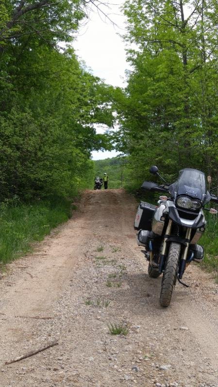
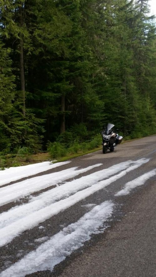
Post your one day ride photo.....

This turned out to be a half-day ride...

Near the north end of Priest Lake, ID...

Regards, Marty
 

Attachments

  • End of the line.jpg
    End of the line.jpg
    98.3 KB · Views: 335
Sorry didn't realize that was the original intent, I'll go back and read the OP. Just trying to share. I'll make sure I read the first post of threads in the future.

Thanks for the pictures Reece. The starting point was too far away for some of us to join the ride. I just looked back at the first responses and noticed that many posted several pictures. No need to apologize as far as I am concerned.:thumb
 
New Bike, Old Bike

Took my new-to-me 89 R100RS out reccently and rode with my buddy on his 68(?) R50? R60?

p1811319309-3.jpg

p1674558830-3.jpg

It was prior to DST so ended up riding home in the darkness. BUT got this cool sunset photo along the way.
 
i-PT57W5J.jpg


i-pKjvvtv.jpg


i-RGmbBPc.jpg


i-MhF3fXC.jpg
 
Yankee Jim Pass at the southern end of Paradise Valley. This pass leads into the northern gate of Yellowstone NP. Yankee Jim once charged a toll to go through the pass.

Annie and I spend our anniversary at Chico Hot Springs in Paradise Valley and then follow-up it up with an early ride through the park on our way home. No tourists.

IMG_0557_zpsjnlgfku7.jpg
 
I took my new-to-me 2014 F800GT over the North Cascades Highway last Saturday. My first extended ride on it for fun and not commuting. I loved the bike. It was about a 300 mile ride over about 8 hours of riding, taking pictures, and hiking.

20160430_161537.jpg

There's a full ride report at the F800Riders.org forum. http://f800riders.org/forum/showthread.php/264434-North-Cascades-Highway-May-2016

It doesn't show up well, but just after the first two pictures is a link to a YouTube video.

Chris
 
I had heard of "concrete arrows", https://en.wikipedia.org/wiki/Transcontinental_Airway_System, that were used as navigational aids during the early years of the Transcontinental Airmail Service and found that was located at the airfield in Anthony Kansas.

i-LWZDcmW-XL.jpg


i-zzqkTpD-XL.jpg


When I arrived at the airport the arrow wasn't readily apparent. The only aircraft on the field was a small helicopter with a two man crew that was going through the checklist prior to take-off. They waved me over and I asked the two young pilots if they knew about the arrow and they had no idea what I was talking about. It seems they were checking power lines in Kansas and were unaware of the old technology.

As luck would have it an older gentleman had arrived to see what was going on with the helicopter. It turns out that he ran a cropdusting service and lived right next to the airport and showed me the arrow and the adjacent beacon. He also invited me to his house to meet his wife who knew all about both the beacon and the concrete arrow. After taking a few photos I dropped by and Mary Copenhaver gave me all the details about their arrow. Mrs. Copenhaver and several others had conducted a great deal of research and had collaborated on an article for the Kansas Magazine a few years ago.

It seems the Postal Service hired Charles Lindbergh to chart airmail routes from Chicago to the West Coast. He determined locations for lighted beacons with a painted arrows pointing the way to the next beacon and arrow. These routes were to be flown both day and night.

Mrs. Copenhaver gave me a copy of their article and a newspaper clipping from August 22, 1929. The article stated that electric power for the beacon light had just been turned on. However, the beacon would not be put into regular service until the runways were completed. There was also some local concern that the light would attract large numbers of insects and could be an issue.

Most of the beacons throughout the country were decommisioned in the 1940s for the scrap metal during the war effort. There was also some worry that the beacons could be used by the Japanese or Germans to navigate the USA for bombing missions. Somehow the beacon at Anthony, Kansas escaped that fate and is still in operation. The arrow has seen better days as you can tell from the photos.

Anyway, neat history, and nice people in the middle of America!
 
Took a short ride today to check out a change I made to my GPS mount.
Freedom Rock north of Greenfield Iowa.
Since 1999 a local artist paints the rock in time for Memorial Day to thank Veterans.
P1030261.JPG


P1030263.JPG


P1030262.JPG
 
Tulliver's first four hour ride. He did exceptionally well, was absolutely focused on me during breaks, and hopped right back in when the breaks were over.


GS and Vstrom enjoying a old unused road

On Sunday my brother and I sent the day riding a bunch of roads that are "open" to the public but generally are only visited by Jeeps, GSs and Vstroms.
This one is near Creemore Ontario which has a nice brewery but we had coffee across the street.:thumb[/ATTACH]
 

Attachments

  • 20160529_120915 (450x800).jpg
    20160529_120915 (450x800).jpg
    87.3 KB · Views: 182
Me and my dad's second annual father son Memorial Day ride.

image.jpgimage.jpg

Dad, after studying a map, took me on a 100 mile loop. At the apex, we pulled into an old cinder block white church and he showed me his mother and grandparents grave. I've rarely met my grandmother growing up, dad and his mom were estranged. Yet, even after death and a lifetime of separation, the bond between a mother and son is still there.
 
Back
Top