Lone*Star
New member
A couple of us from the NoCal chapter of the Chromeheads had discussed doing a day ride on the 49er highway in February or early March. Little League season is upon us and free time is getting limited. We set the date for 2/22 and put a thread on the
Chromeheads website. No matter how many times I looked at the weather forecast the "50% chance of rain" wouldn't go away. So I figured we'd ride in the rain for 1/2 the time.
When the garage door went up at 5:45am Sunday morning, the conditions were as expected - a slow rain and the ground and road looked like it had been raining all night. "Who's going to show up," I wondered. Several of these guys that had replied to the post had a long way to go just to get to Antioch. And it would likely be raining most of the day.
One benefit of planning a ride route is to have it start close to home. I took full advantage and established the first meeting place a 1/2 mile from home. I pulled into the gas station about 10 to 6 - empty. Okay, so I'll fill up. Not long after I top off, I hear a distinctive Z-Technik exhaust note. Hmmmm - who might this be. Steve pulls in sporting a CL. I had not met him before.

Steve asked "Are you really going to ride in this?" I liked him immediately.
Before long Martin, the mileage king, comes strolling in. He hit the road at 5am from Mountain View to make there just after 6. What he didn't tell us until later was that he worked until midnight the night before. Martin gets the Dedication Award. Martin plans to top 100K on his R12C in '04.

Chuck was the 4th to arrive around 6:15. When asked when he had to leave, he replied about 6. Huh? He had ridden down from Santa Rosa last night and got a room.

Chris from Vallejo was the last to arrive around 6:20. Everyone who had signed up was here. That never happens.

It was getting close to 6:30 and I thought they were going to bench race all morning. Let's go! A quick discussion on the route and the 2 minute warning.

We pulled back on to Lone Tree Way and then south down Deer Valley. This road leaves the burbs in a hurry. It's still very dark and the rain is steady but slow. I hit a few large puddles of standing water in the road. It's enough to keep you on your toes with the limited visibility. We have the road completely to ourselves.
Dear Valley runs into Marsh Creek. Here we headed east toward Hwy 4 and Stockton. As we rode across the Delta, I saw a flock of about 20 egrets take off. I also noticed a blue heron flying away. The fields on the side of the road are very wet and birds are everywhere. Visibility was about a 1/2 mile at this point. I realized this would be a day to take-in the surroundings and keep the pace slow.
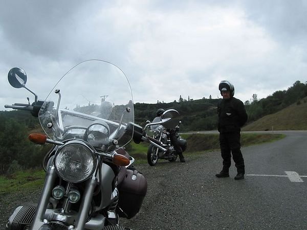
Just north of Stockton we picked up Hwy 26 east. This is another country hwy with a few nice twisty sections. It about 7:15 now and the fog had lifted. It was still raining but not bad. 26 runs into Hwy 12 at Valley Springs. Instead of following 12/26, I had decided to ride up around Pardee Reservoir. The roads on the map got lost but I stayed generally north and east toward Jackson. We found Chile Camp Road and Camp Seco Rd. These were great small 1-lane roads. Very tight and twisty but good pavement. I saw a coyote run through a field of horses. We finally caught up with Stoney Creek Road which puts you into Jackson. We paused for a quick photo op as this was one of the more scenic spots so far.

We pulled into Jackson around 8:30. David from San Andreas was waiting on us. Well, kinda. He had already ordered.
Mel and Faye's had moved about 100 yards south on 49. Still a great place with very good service.
Hi 'flug

I enjoyed talking to David about his mods to his R12C. The GS cams seem to have the most impact. The 1150GS exhaust header had been a problem though. He wouldn't be able to ride any with us as he needed to drop the header. I did check out his bike in the parking lot and it does have quite a bit of spunk. Thanks for the loan David.
After breakfast, we headed north on Hwy 49 to Gold Country. We headed through Sutter Creek, Drytown and Plymouth. I had decided to explore a small side road - Union Mine Road. Martin decided to bail at this point as sleep was looking more important than more rain riding. It was great to get to ride with Martin again.
Union Mine was my favorite type of road. Only about 12 miles, but tight, twisty and no center line. There are a number of local on this road so it requires good concentration. The rain was slow, so a photo op was in order.

Union Mine runs back into 49 just south of Placerville. North of Placerville is what I think about when I think about the Forty Niner Highway. This road was great. We cleared most of the traffic as it was light. The pace was ours to make. Light rain off and on and good pavement if somewhat damp. Everything is green from the winter rains. The road is almost empty. No other bikes on a road that is full on any sunny spring Sunday. The rain is good.
As we go through Coloma - where the Gold Strike Park is- the rain is a little too heavy for a photo op. There were many great spots for photography that were just too wet to get the camera out during this ride.
There is a classic point on 49 just south of Auburn. The road winds down into the canyon toward the confluence of 2 forks of the American River. The rain fell hard in this section and the tar snacks were slicker'n slot. Throttle control was the order of the day. After you cross the river, 49 climbs out of the canyon into Auburn.

We gased up in Auburn. Chuck and Steve decided that they have earned their Throttle control pin - and they had. They decided to blast down 80 back to the Bay Area. It was good riding with Chuck and Steve and hope to again soon. That left just Chris and me.
Chris and I headed north on 49 to Nevada City. The rain started really coming down. We hit some hard, driving rain. This part of the Hwy is boring and 4-lane. As the elevation climbed, it got colder. I notice the "Chains Required" signs were sideways. A good sign when you are on 2 wheels. When 49 turned off of Hwy 20, the road got better for riding. Two lane and more curves but still raining good. We started to decend toward the Yuba River canyon. This road would be great when dry. Very twisty and awesome scenery. Not only were tar snakes still sneaking about, we had sand on the road. This is the sand used for ice so it was mainly in the center of the road. It still required attention.
After we climbed out of the river canyon, I started looking for Pleasant Valley Rd. We turned back southwest on this road. You never know looking at a map if a road is good for a bike or not. This one proved to be great. Tight, twisty, great pavement and the rain slacked up as we turned off. This was good.

Within a few miles we again started to descend into the Yuba River canyon. This road is much tighter than 49 - the drop-offs are incredible. Damn the rain - more documentation.


As we made it to the bridge that crossed the river, we noticed a covered footbridge nearby.

This was a two thumbs-up road.
Careful in the rain or dry but the views were worth it. The river running strong with all the rain and everything so green. The pictures couldn't do it justice.
Chromeheads website. No matter how many times I looked at the weather forecast the "50% chance of rain" wouldn't go away.
So I figured we'd ride in the rain for 1/2 the time.When the garage door went up at 5:45am Sunday morning, the conditions were as expected - a slow rain and the ground and road looked like it had been raining all night. "Who's going to show up," I wondered. Several of these guys that had replied to the post had a long way to go just to get to Antioch. And it would likely be raining most of the day.
One benefit of planning a ride route is to have it start close to home.
I took full advantage and established the first meeting place a 1/2 mile from home. I pulled into the gas station about 10 to 6 - empty. Okay, so I'll fill up. Not long after I top off, I hear a distinctive Z-Technik exhaust note. Hmmmm - who might this be. Steve pulls in sporting a CL. I had not met him before.
Steve asked "Are you really going to ride in this?" I liked him immediately.
Before long Martin, the mileage king, comes strolling in. He hit the road at 5am from Mountain View to make there just after 6. What he didn't tell us until later was that he worked until midnight the night before. Martin gets the Dedication Award. Martin plans to top 100K on his R12C in '04.
Chuck was the 4th to arrive around 6:15. When asked when he had to leave, he replied about 6. Huh? He had ridden down from Santa Rosa last night and got a room.
Chris from Vallejo was the last to arrive around 6:20. Everyone who had signed up was here. That never happens.
It was getting close to 6:30 and I thought they were going to bench race all morning. Let's go! A quick discussion on the route and the 2 minute warning.
We pulled back on to Lone Tree Way and then south down Deer Valley. This road leaves the burbs in a hurry. It's still very dark and the rain is steady but slow. I hit a few large puddles of standing water in the road. It's enough to keep you on your toes with the limited visibility. We have the road completely to ourselves.
Dear Valley runs into Marsh Creek. Here we headed east toward Hwy 4 and Stockton. As we rode across the Delta, I saw a flock of about 20 egrets take off. I also noticed a blue heron flying away. The fields on the side of the road are very wet and birds are everywhere. Visibility was about a 1/2 mile at this point. I realized this would be a day to take-in the surroundings and keep the pace slow.
Just north of Stockton we picked up Hwy 26 east. This is another country hwy with a few nice twisty sections. It about 7:15 now and the fog had lifted. It was still raining but not bad. 26 runs into Hwy 12 at Valley Springs. Instead of following 12/26, I had decided to ride up around Pardee Reservoir. The roads on the map got lost but I stayed generally north and east toward Jackson. We found Chile Camp Road and Camp Seco Rd. These were great small 1-lane roads. Very tight and twisty but good pavement. I saw a coyote run through a field of horses. We finally caught up with Stoney Creek Road which puts you into Jackson. We paused for a quick photo op as this was one of the more scenic spots so far.
We pulled into Jackson around 8:30. David from San Andreas was waiting on us. Well, kinda. He had already ordered.
Mel and Faye's had moved about 100 yards south on 49. Still a great place with very good service.
Hi 'flug
I enjoyed talking to David about his mods to his R12C. The GS cams seem to have the most impact. The 1150GS exhaust header had been a problem though. He wouldn't be able to ride any with us as he needed to drop the header. I did check out his bike in the parking lot and it does have quite a bit of spunk. Thanks for the loan David.
After breakfast, we headed north on Hwy 49 to Gold Country. We headed through Sutter Creek, Drytown and Plymouth. I had decided to explore a small side road - Union Mine Road. Martin decided to bail at this point as sleep was looking more important than more rain riding. It was great to get to ride with Martin again.
Union Mine was my favorite type of road. Only about 12 miles, but tight, twisty and no center line. There are a number of local on this road so it requires good concentration. The rain was slow, so a photo op was in order.
Union Mine runs back into 49 just south of Placerville. North of Placerville is what I think about when I think about the Forty Niner Highway. This road was great. We cleared most of the traffic as it was light. The pace was ours to make. Light rain off and on and good pavement if somewhat damp. Everything is green from the winter rains. The road is almost empty. No other bikes on a road that is full on any sunny spring Sunday. The rain is good.
As we go through Coloma - where the Gold Strike Park is- the rain is a little too heavy for a photo op. There were many great spots for photography that were just too wet to get the camera out during this ride.
There is a classic point on 49 just south of Auburn. The road winds down into the canyon toward the confluence of 2 forks of the American River. The rain fell hard in this section and the tar snacks were slicker'n slot. Throttle control was the order of the day. After you cross the river, 49 climbs out of the canyon into Auburn.
We gased up in Auburn. Chuck and Steve decided that they have earned their Throttle control pin - and they had. They decided to blast down 80 back to the Bay Area. It was good riding with Chuck and Steve and hope to again soon. That left just Chris and me.
Chris and I headed north on 49 to Nevada City. The rain started really coming down. We hit some hard, driving rain. This part of the Hwy is boring and 4-lane. As the elevation climbed, it got colder. I notice the "Chains Required" signs were sideways. A good sign when you are on 2 wheels. When 49 turned off of Hwy 20, the road got better for riding. Two lane and more curves but still raining good. We started to decend toward the Yuba River canyon. This road would be great when dry. Very twisty and awesome scenery. Not only were tar snakes still sneaking about, we had sand on the road. This is the sand used for ice so it was mainly in the center of the road. It still required attention.
After we climbed out of the river canyon, I started looking for Pleasant Valley Rd. We turned back southwest on this road. You never know looking at a map if a road is good for a bike or not. This one proved to be great. Tight, twisty, great pavement and the rain slacked up as we turned off. This was good.
Within a few miles we again started to descend into the Yuba River canyon. This road is much tighter than 49 - the drop-offs are incredible. Damn the rain - more documentation.
As we made it to the bridge that crossed the river, we noticed a covered footbridge nearby.
This was a two thumbs-up road.
Careful in the rain or dry but the views were worth it. The river running strong with all the rain and everything so green. The pictures couldn't do it justice.
Last edited: