Navigation
Install the app
How to install the app on iOS
Follow along with the video below to see how to install our site as a web app on your home screen.
Note: This feature may not be available in some browsers.
More options
-
Welcome, Guest! We hope you enjoy the excellent technical knowledge, event information and discussions that the BMW MOA forum provides. Some forum content will be hidden from you if you remain logged out. If you want to view all content, please click the 'Log in' button above and enter your BMW MOA username and password. If you are not an MOA member, why not take the time to join the club, so you can enjoy posting on the forum, the BMW Owners News magazine, and all of the discounts and benefits the BMW MOA offers?
-
Beginning April 1st, and running through April 30th, there is a new 2024 BMW MOA Election discussion area within The Club section of the forum. Within this forum area is also a sticky post that provides the ground rules for participating in the Election forum area. Also, the candidates statements are provided. Please read before joining the conversation, because the rules are very specific to maintain civility.
The Election forum is here: Election Forum
You are using an out of date browser. It may not display this or other websites correctly.
You should upgrade or use an alternative browser.
You should upgrade or use an alternative browser.
Tuesday stepping out
- Thread starter Autolycus
- Start date
tuesday ride
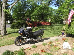
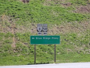
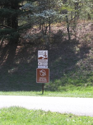
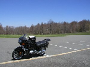
Left out from Greensboro in the chilly morning. Not quite rounder cold, but for us southerners it was cold enough in mid 50s. Heading for one of my fav haunts, the blue ridge parkway
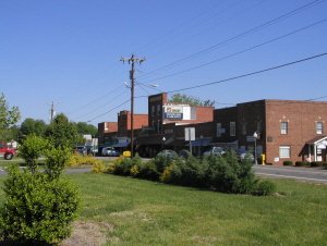
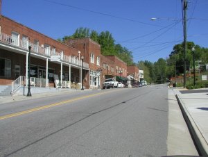
This is typical Caroline small town. This happens to be Stokesdale, NC, about 15 miles from Greensboro. Im a transplant from NJ, and it took me awhile to get used to going from urban to rural in no time.
Left out from Greensboro in the chilly morning. Not quite rounder cold, but for us southerners it was cold enough in mid 50s. Heading for one of my fav haunts, the blue ridge parkway
This is typical Caroline small town. This happens to be Stokesdale, NC, about 15 miles from Greensboro. Im a transplant from NJ, and it took me awhile to get used to going from urban to rural in no time.
Attachments
tuesday ride
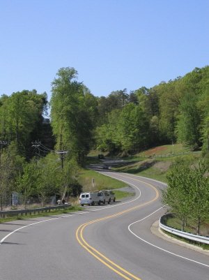
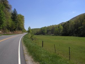
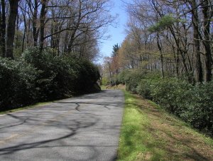
Eveybody has their fav roads. One of mine is 89. Fine riding road. Technical double apex off camber twisties, to sweepers, to gentle s as in photo. This 40 miles ending in Mt. Airy, NC (better know around the world as Mayberry, RFD) is a brilliant ride!
Eveybody has their fav roads. One of mine is 89. Fine riding road. Technical double apex off camber twisties, to sweepers, to gentle s as in photo. This 40 miles ending in Mt. Airy, NC (better know around the world as Mayberry, RFD) is a brilliant ride!
Attachments
tuesday ride
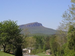
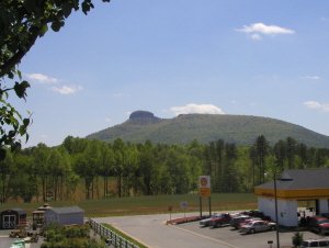
Alas, my route today departs from 89 in Danbury NC, home to Hanging Rock State Park. About 40 miles out, now, and these are the first mountains. This view from route 8 heading north. Hanging Rock is neat place to rock climb, or to stand in an ice cold waterfall when it's 200 in August
Alas, my route today departs from 89 in Danbury NC, home to Hanging Rock State Park. About 40 miles out, now, and these are the first mountains. This view from route 8 heading north. Hanging Rock is neat place to rock climb, or to stand in an ice cold waterfall when it's 200 in August
Attachments
tuesday ride
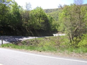
Hard to convey the approach to the parkway. This is the climb up to Tuggles Gap, VA. Nice twisties. Climb is about 6 miles of switchbacks, off camber blind corners. The turns are very close together, but so acute you can't see more than one small section at a time.
Hard to convey the approach to the parkway. This is the climb up to Tuggles Gap, VA. Nice twisties. Climb is about 6 miles of switchbacks, off camber blind corners. The turns are very close together, but so acute you can't see more than one small section at a time.
Attachments
tuesday ride
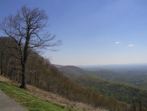
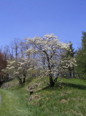
I went southbound, back towards NC. I can hear all the rounders groaning, but it was cold up there. Spring is still a ways off in the high country. Down on the flats we've had leaves on the trees for several weeks, while up on the parkway it's only now beginning to be spring. This view from Rocky Knob
I went southbound, back towards NC. I can hear all the rounders groaning, but it was cold up there. Spring is still a ways off in the high country. Down on the flats we've had leaves on the trees for several weeks, while up on the parkway it's only now beginning to be spring. This view from Rocky Knob
Attachments
tuesday ride
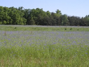
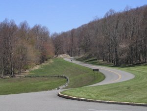
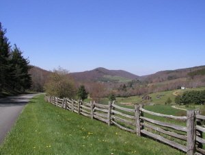
Y'all should know where the Tar Heel blue comes from. Sky was cloudless all day. This shot is typical parkway. Gotta be one of the best roads anywhere for bikes. No stop signs for 500 miles, fairly challenging (tho not very many twisties) and no trucks. Also, during the week, very little traffic.
Y'all should know where the Tar Heel blue comes from. Sky was cloudless all day. This shot is typical parkway. Gotta be one of the best roads anywhere for bikes. No stop signs for 500 miles, fairly challenging (tho not very many twisties) and no trucks. Also, during the week, very little traffic.
Attachments
tuesday ride
this is view from foxhunters paradise overlook, taken at 10X. The peaks on the horizon are, from left to right, Hanging Rock (as seen in post 4, I believe) and Pilot Mountain. Distance from Hanging Rock to Pilot is about 40 miles, and I an probably 60 miles from Pilot. Anybody guess why it's called the blue ridge?
this is view from foxhunters paradise overlook, taken at 10X. The peaks on the horizon are, from left to right, Hanging Rock (as seen in post 4, I believe) and Pilot Mountain. Distance from Hanging Rock to Pilot is about 40 miles, and I an probably 60 miles from Pilot. Anybody guess why it's called the blue ridge?
Attachments

BRADFORDBENN
Slowpoke & Proud of It!
Very nice. Thanks for the pics.
Similar threads
- Replies
- 1
- Views
- 247